On the morning of May 31th of 2012, the Storm Prediction Center was already concerned about the day and immediately placed a enhanced risk over a small region of Texas including the cities of Houston, Waco, Austin, and Killeen. The tornado probability was in a 10% zone imbedded in the enhanced risk, the area was shaded dark so significant tornadoes were favorable for the area. 9:42 AM, the SPC had upgraded the risk to moderate and a tornado watch was issued with a chance of 30%, the risk was upgraded to high at 10:04 AM, the chances of tornadoes skyrocketed to a 45% chance, many shows had the news pop up on random times when the weather changes, now, many people were worried and had packed up and got ready for the storm or evacuated the area.
The Afternoon[]
In the afternoon, weather took a big turn, from sunny, to thunderstorming. Winds from these storms were up to 60 mph, blowing trees and making the rain and hail in them blow sideways, all 5 of the supercells were very strong, they had 6.5 inch hail on them and winds of now 80 mph, a PDS severe thunderstorm warning was issued as the storm moved east at 12 mph. A few minutes later, a tornado warning was issued, The rotation on velocity was very strong, CC was showing a debris ball with a huge clear spot in the dark blue indicating there was a very, very strong tornado on the ground, the tornado did look like a weak rope tornado, but the tornado's boundary was very wide, the boundary was a half mile wide with 190 mph winds on its outskirts and 200+ mph winds in the actual tornado. the tornado became rainwrapped while throwing cars 6000 feet in the air and crashing into the ground at max speeds of 110 mph, the cars caused widespread fires and road crackings. The tornado turned into a stovepipe and a mix of a wedge tornado in 1 minute, It was 2 miles from entering Waco, TX. The tornado was hitting small shacks and houses, Storm chasers were tracking the tornado, storm spotters were reporting a wedge tornado on the ground, One storm chaser captured a very cool photo of the tornado, showing the tornado throwing debris in the air while small vortices snaking outwards from the tornado. The tornado was moving slow, moving at a groundspeed of 15 mph, moving east toward Waco, TX. When the next hour hit, it was in the outskirts of Waco, TX at 2:00 in the afternoon, Houses were being ripped off of their foundation and torn apart by the twister, then flying out of the twister and bursting out windows, trees were falling on houses, multiple powerflashes occurred while a house generator being exploded by the strong winds of the tornado, luckily, the tornado only hit the less dense parts of Waco, It soon exited Waco moving east at 17 mph, it crossed the Brazos River, It peaked outside of town at winds of 241 mph, trees had fell and been threw up straight into the tornado before being spat out of the tornado crashing into the ground, knocking other trees down, the ground was bare and had a deep ditch following the tornado's path indicating it was ground scouring, the pit was 4 feet in depth, the tornado had finally dissipated at 3:51 PM along a 80 mile path.
Aftermath[]
After the tornado dissipated, the tornado was then rated an EF5 with winds of 241 mph according to the survey, most of Waco's suburbs has been destroyed by the 0.94 mile wide tornado, bare slabs were left from the town, only 5 trees were lest standing, debarked, struck by lightning, and lost their leaves from the tornado. Those trees will remember the citizens of the EF5 tornado as the town rebuilds.
Photos[]
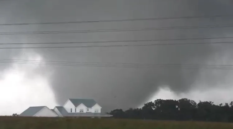
A photo of the EF5 one of the storm spotters took
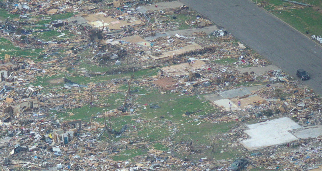
The damage from the twister.
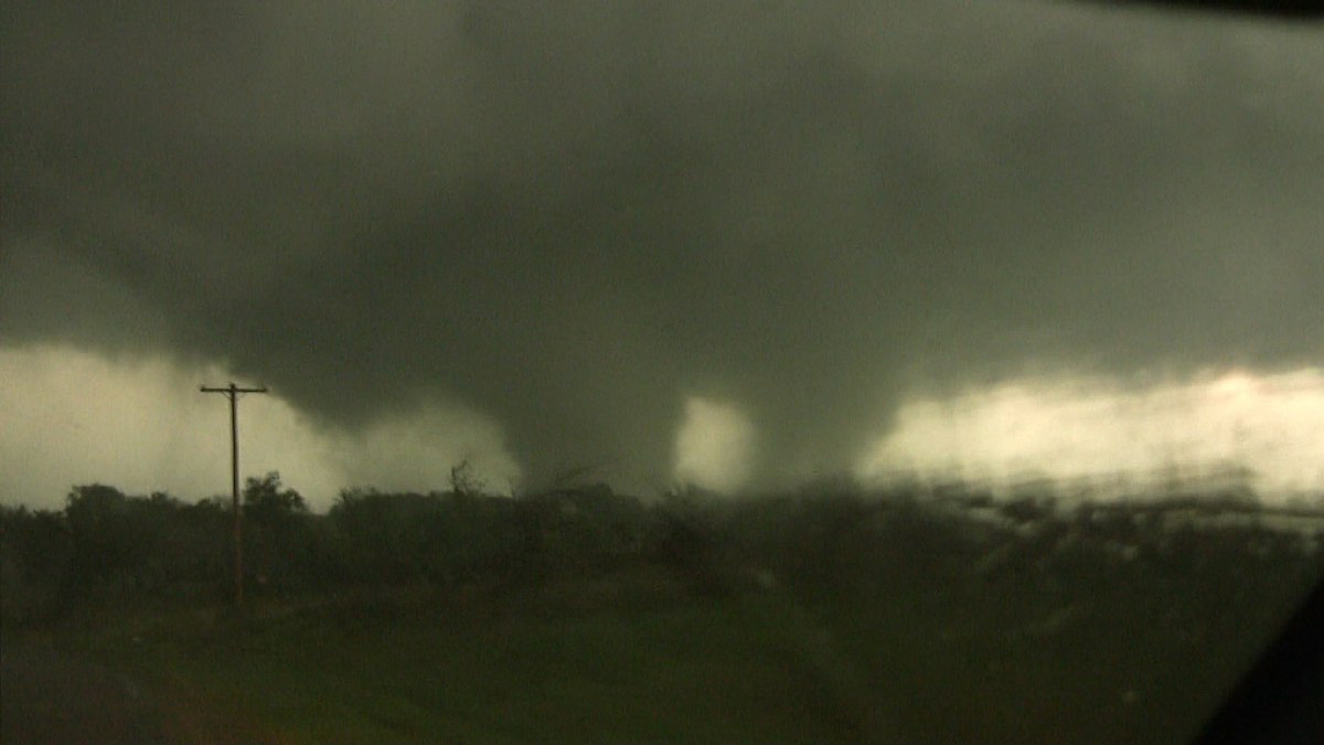
The tornado 2.5 miles away from Waco as a multi vortex.
Radar Images[]

The supercell dropping 6 inch hail.


The tornado on radar entering Waco, TX.

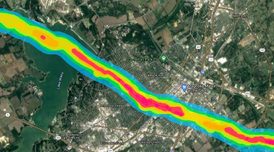
The damage swaft of the EF5. (Blue = EF0 Green = EF1 Yellow = EF2 Light Orange = EF3 Dark Orange = EF4 Red = EF5)