| EF4 tornado (NWS) | |
|---|---|
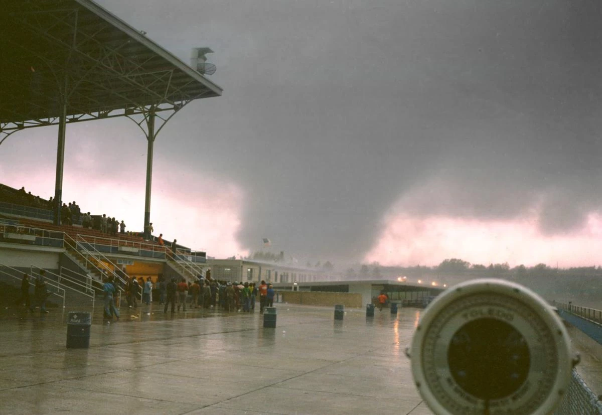 The tornado as it passes near Yuma International Airport. | |
| Date | September 10, 2013 |
| Times | 1726-1818 |
| Touchdown location | 1 SW of Ciudad Morelos, MX |
| Highest winds |
170 mph (270 km/h) |
| Injuries | 133 |
| Fatalities | 55 |
| Damage | $30 million (2013 USD) |
| Areas affected | Areas surrounding Yuma, Arizona |
| Part of the Tornadoes of 2013 and the 2013 Sonora-Arizona/California tornado outbreak | |
the 2013 Ciudad Morelos-Yuma-Dome tornado was a large, long-tracked and deadly tornado. It was also the strongest tornado in Arizona state history.
The tornado was the strongest in a tornado outbreak of 10 other tornadoes, with most of the other tornadoes being weak. The tornado was also one of few on record to track through more than one country, touching down in Mexico and lifting in the United States.
Meteorological history[]
On September 10, 2013, the SPC issued a Moderate Risk of Severe Thunderstorms for portions of southeastern California, southern Arizona and southwestern New Mexico.
The outlook as of 1630z on September 10.
This was the first of such outlook issued west of the Rocky Mountains since 2004, when a small tornado outbreak impacted Utah.
At 1528, Tornado Watch #406 was issued for much of southeastern California and southern Arizona. It noted the possibility of "Several tornadoes, with a couple intense tornadoes possible".
The supercell that would go on to produce this tornado previously produced a F1 tornado near Tecolotes, Baja California, Mexico.
The Servicio Meteorológico Nacional (SMN) issued a Tornado Warning for the city of Ciudad Morelos and surrounding areas at 1715, and the NWS in Phoenix followed suite by issuing a tornado warning for Yuma County at 1716.
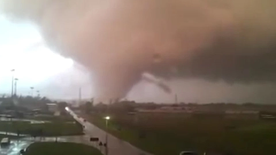
A image of the tornado as it crossed through Ciudad Morelos, Mexico.
At 1725, a funnel cloud was spotted about 1 and a quarter miles southwest of Ciudad Morelos, roughly 8 miles southwest of the United States-Mexico border.
The funnel cloud touched the ground at 1726, and entered the town of Ciudad Morelos at 1728.
A block of houses sustained significant damage at 1729, where 9 of the 55 deaths occurred. The damage here was estimated at F2-F3 intensity, with a single house sustaining possible F4 damage.
The tornado continued through the town, carrying cars, and a receipt from a gas station in Ciudad Morelos was found near Tacna, Arizona a week later. Of the 55 deaths recorded in this tornado, 28 of them occurred at Ciudad Morelos.
The tornado neared the border at around 1740 as a F3-F4 tornado, lifting a car roughly 30 feet from it's original position near a border crossing.
The tornado crossed the border from Mexico into the United States at 1742, being the last tornado until January 14, 2018 to do so.
The tornado entered the Yuma city limits at 1749, and caused catastrophic damage. The winds caused by the storm caused a small Cessna to slide off the runway of a local airstrip, resulting in a indirect death.

EF4 damage to a house in Yuma, Arizona.
The tornado struck several blocks of houses, tearing down walls, and partially sweeping a house from it's foundation, with that house being the only evidence of EF4 intensity in Yuma.
The tornado continued through Yuma, weakening to a EF2 tornado as it moved through downtown Yuma, causing 19 of the 26 deaths recorded in the city.
The tornado exited the city of Yuma at 1804, and entered the ghost town of Dome, Arizona as a EF1 at around 1810. 1 death occurred in Dome as a result of this tornado, when a driver's car was thrown off the road.
Finally, at 1818, the tornado lifted about 2 miles northeast of Dome, Arizona.
Aftermath[]
Mexican president Enrique Peña Nieto declared a state of emergency for northeastern Baja California and northern Sonora on September 11 as a result of the tornado outbreak. The governor of Arizona, Jan Brewer declared a state of emergency late on September 10.
Barack Obama, the 44th US president, declared Yuma County a federal disaster zone on September 13, mainly due to the EF4 in Yuma.