| EF5 tornado | |
|---|---|
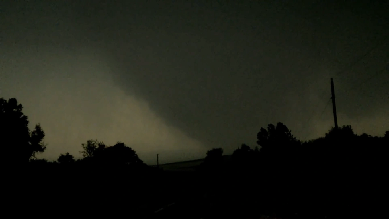 The Houston Tornado as it was 34 miles outside the city | |
| Date | May 3, 2018 |
| Times | 204312Z - 225637Z (2hrs, 13m, 25s) |
| Touchdown location | Brenham |
| Highest winds |
321 MPH |
| Injuries | 200,000+ |
| Fatalities | 4,035 |
| Damage | > $18 billion (2018 USD) |
| Areas affected | NE of Brenham-Hempstead-Prairie View-N of Waller-Hockey-NW Houston-Houston Metro-Pasadena-Edgebrook-Seabrook, TX |
| Part of the Tornadoes of 2018 (Wolf) May 1-12 Tornado Outbreak Sequence | |
The 2018 Northwest Houston-Pasadena Tornado was a particularly intense EF5 that touched down to the NE of Brenham in Washington County, TX and was on the ground for over 2 Hours as it tore a path of destruction 105 miles long, from Brenham to Seabrook, killing 4,035, injuring more than 200,000, and doing over $18 billion (2018 USD) in damages. To this day it remains as the costliest and deadliest tornado in history. This was one of 37 EF5s confirmed during the May 1-12, 2018 Tornado Outbreak Sequence.
Meteorological Synopsis[]

Convection Outlook for May 2nd, 2018.
At 2000Z on May 2, a HIGH Risk was issued for for May 3 encompasing a large region stretching from TX to TN. This was thanks to a broad, large-scale trough that was sweeping its way into the CONUS that week, with an ever deepening Mid-Latitude Low Pressure settling over the Central US. This Low Pressure would come to situate itself over Oklahoma the next day with a pressure of 951.6 mbar, the lowest extratropical pressure ever recorded in the United States. By 0600Z on May 2, 2018, the SPC had become more confident in the fact that extremely significant and potentially destructive severe weather would be taking place, especially over the ArkLaTex region. Thanks to significant advection of moisture in the region, CAPE values by late morning had ballooned into the 6000 J/kg range and greater, and an advancing dryline from the west in Central Texas sought to generated substantial lift in the early afternoon in the eastern half of the state. On top of that was an extreme level of Helicity in the region greater than >900 m2/s2. This was thanks to a strong, moist, surface inflow jet coming from the gulf due to a strong High pressure situated in the Caribbean. This Jet intersected the eastward flow generated by the trough at extreme ageostrophic angles, specifically in East Texas where this jet intersected the flow at a 100° angle. This generated some local Helicity of up to >1000 m2/s2, far in excess of what is needed to sustain long-track, violent tornadoes.
Storm Track and Development[]
At around 1915Z, dozens of cells exploded into a line from the east of Austin to a little SW of Dallas-Fort Worth, a region where MLCAPE had exceeded 7000 J/kg by the afternoon; generating extreme instability in the atmosphere. Within thirty minutes the storms had reached severe status, being warned for grapefruit-sized hail and damaging downbursts upwards of 90 MPH. By 1945Z, eleven tornado warnings had been issued for the system, including one for a particularly broad and powerful circulation in the largest and southern-most storm. Despite not being a very tight circulation, Doppler radar indicated windspeeds of 100+ MPH, with some spots reaching speeds of 140 MPH. Spotters in the area reported a large and low, rapidly rotating base with exceptionally strong inflow. The power of the SVC indicated a potential for this storm to be long-tracked and damaging. Some small funnels were reported dancing along the ground briefly. Whether these were the start of the EF5 or some trailing EF0 before the EF5 got started is still debated. (Currently they are counted as precursor EF0s)
At 2027Z, a Tornado Emergency was issued for Brenham, TX in Washington County as the circulation had begun to tighten as it approached the small populace. DOW that had caught up to the storm reported winds at the base of the circulation to be in excess of 130 MPH. At 2040Z, storm spotters reported seeing several large, brief funnels dancing around under a massive, low base, with the violent motion in the wall cloud sometimes reaching the ground itself. Despite the HP state of the storm, the low base was relatively dry, prompting great visibility and hordes of chasers to come see the behemoth that was about to form before them. Some spotters pointed out violent winds underneath the base scouring the ground, as well as long, horizontal vortices that danced about violently and even touched the ground at times, severely tearing up the topsoil. At 2043Z, the entire base passed over a large, two story house. Storm spotters reported that the house immediately exploded into splinters, killing all 5 inside. The debris was finely granulated underneath the low, violent base with the tiny fragments now highlighting the many violent sub-vortices that lurked beneath the lowering. The concrete slab of the house was lifted from the ground as the vortices scoured the earth around its base. The foundation cracked and broke as it was shifted several yards from its original position. Its Anchor Bolts were completely sheared away, and the surface of the slab was deeply scoured by the finely granulated debris. A car in the driveway was lofted a few hundred feet in the air and flung over a mile, obliterating the car body, stripping the chassis bare and ripping the chassis apart with only pieces being recovered. Damage here was rated well into the EF5 range.
The storm continued ESE at 50 MPH, the base quickly lowering to the ground. Because the storm paralleled closely to US Route-290, Spotters and DOW were able to get close enough to get data measurements close to the surface. At 2051Z DOW measured windspeeds 30ft off the surface at 301 MPH as the storm approached Chapple Hill. At 2054Z, a Tornado Emergency for Chapple hill was issued. At 2058Z, it passed through the town and completely swept away 90% of Chapple Hill, killing 23. Most of the damage was found to be bare, heavily scoured slabs, with several shifted from their positions. Some slabs were cracked, and well built homes had their anchor bolts removed from the foundation. Cars in Chapple hill were tossed as far as 1.5 miles, completely obliterated by the storm. Vast swaths of wind-rowed debris was noted. At this point, one of the DOW had recorded windspeeds in excess of 305 MPH at 30ft above the surface, and they were increasing. Spotters reported seeing the main condensation funnel lifting at times, revealing massive vortices rapidly orbiting around the central vortex, and several large, snaky horizontal vortices dancing about the surface. The ground here was severely scoured, only leaving bare mud and soil in its wake. Some spots were scoured up to 2 ft. Damage here was also rated well into the EF5 range.
As the storm continued to parallel US-290, it completely swept away multiple farms, and the Chapple Hill Sausage Company HQ and Justice of the Peace office, killing 7. It then suddenly arched SE towards Hempstead. Due to the sudden nature of the direction change, one DOW was struck by the outer bands of the storm and rolled over with the passengers and driver sustaining minor cuts and bruises. The storm then suddenly arched back to ESE, clipping the northern edge of Hempstead, obliterating several-dozen structures. During this erratic movement, the tornado's forward speed had increased to over 70 mph, giving little warning to Hempstead. 52 people were killed.
As it jumped back across US-290, 13 people were killed as cars, vans, trucks, and semis were hurled for several-hundred yards and up to a mile away, obliterating the vehicles in the process. Pavement on US-290 was scoured and stripped away as the storm passed over it. As it righted its track, the storm cut straight through the heart of Prairie View, leveling the entire town and destroying Prairie View A&M University, killing 110. After which the forward speed slowed to 30 mph, generating extreme ground scouring up to 41 inches deep. Houses in this area were completely wiped away, their slabs being lifted off the ground and tossed dozens of yards, being destroyed in the process. 9 people were killed.
At 2123Z, DOW measured windspeeds of 314 mph 30ft above the surface. At this point, the tornado was 2.5 Miles wide, nearly as wide as the El Reno 2013 tornado, and still growing. At 2127Z the tornado accelerated to the SE, again crossing 290 US-290. In the process the city of Waller, TX took a direct hit. The Waller Junior High School was completely swept away. Debris from the building was scattered for miles. Numerous houses in the Northern half of town were completely swept away, with nothing but cracked, scoured, bare slabs present. 44 people died in Waller.
The tornado then suddenly arched back ESE. Houses along this path were completely wiped away, killing 18; the anchor bolts being completely removed from the foundations. At 2144Z, The town of Hockley was completely wiped off the face of the Earth, killing 27. 12 others were killed as the storm passed directly on top of US-290 in the process, deep swaths of pavement being stripped away. One chaser vehicle sustained a flat tire as it traveled across the ruined road. Hockley would never recover from the storm.
The storm continued ESE, passing through Ranch Country, leveling the neighborhood and killing 38, the storm then arched East towards the Rose Hill Sub-Division of Houston. A Tornado Emergency was issued for the entire city of Houston as the tornado approached at 2158Z. Only a few miles away from Rose Hill, DOW recorded winds of 321 MPH at 30ft above the surface, the fasted recorded winds on Earth. The damage path here was measured at 2.9 miles, the widest tornado ever recorded. The ground here was scoured to a depth of 29 inches by the intense sub-vortices within the storm.
At 2200Z, the storm passed over the Rose Hill sub-division. Houses in the suburb were swept cleanly away, with not even bare slabs remaining for several homes. Well built houses were sheared from their foundations and exploded in midair. Streets were entirely wiped away, leaving only muddy paths littered with small fragments of houses and the occasional intact coffee mug. Cars in this area were never to be found again, if not only piece remained. 21 people were killed in Rose Hill as the tornado passed by. Incredible wind-rowing of debris was noted in this area.
The storm then banked sharply right and continued along US-290 at a SE trajectory, directly into the densely populated Cypress Suburbs. Houses here were swept away along with their foundations. Basements in a few homes collapsed as extremely violent vortices passed over them, the slabs that covered them being ripped away and tossed several dozen yards. Manufactured homes were finely granulated and centrifuged outwards for miles, slabs being severely scoured by the small fragments. 109 people were killed as the storm passed through Cypress. The presence of a few basements helped reduce possible fatalities, however most other division won't be so lucky. Most of Houston is situated on what used to be swampland, making basements impractical and rare, especially in more southern portions of the city.
The storm continued SE, sweeping away numerous houses along its path. The Jersey Village suburb was completely swept away as the tornado passed over. Anchor Bolts in well built homes removed from their foundations. 186 were killed in Jersey Village.
The storm continued to move SE, passing over the Sam Houston Tollway, flinging cars against the overpasses and collapsing them. Due to the wind tunnel effect as a result of the overpasses, it is believed the storm intensified briefly as it went over, sucking cars out from under them and dragging civilians out from under their false shelter. It is believed at least 60 people died from hiding in overpasses in this area. Concrete pavement here was severely scoured down to the re-bar and support trusses as heavy car parts smashed and dragged against them. Several victims were found to have been ripped from their vehicles and left unrecognizable, requiring dental record to identify them.
The storm continued SE towards downtown, sweeping away houses and tossing vehicles several hundred yards to a mile away. From here the storm drifted a little east, taking the tornado away from US-290 and sparring downtown. However, the neighborhood of Oak Forest/Garden Oaks subdivision was now directly in its path. The entire neighborhood was flattened, with debris being scattered for miles. All structures in this area were reduced to scoured foundations and vehicles were tossed into nearby communities, smashing through houses. 240 lives were lost.
The tornado then continued into Shady Acres, flattening half of the community and killing 119. Now moving at 75 MPH, the storm continued to drift E as it traveled SE, completely flattening the Greater Heights Suburb and hurling cars up to a mile away. Due to the constant narrow alley ways and streets, a wind tunnel event had intensified the storm further, causing the RFD to push the storm to the east.
As the tornado continued SE, it began to become rain-wrapped as the RFD pulled in rain and hail from the Rear Flank of the storm. Straight line winds of 170 MPH flipped cars and flattened poorly built houses. The tornado tore through the Northside of Houston, cars being flung into downtown a mile away. In some cases cars and other vehicles were logged into the upper levels of skyscrapers. 291 people died as the storm passed to the north and northeast of downtown.
By 2231Z the storm approached I-10, completely obscured by rain and large hail. Winds picked up as the storm rolled into the I-10 corridor. As the storm passed over I-10, several large stores, hundreds of homes and a dozen office buildings were severely damaged or destroyed. Cars were flung off the interstate and obliterated, overpasses collapsed, and numerous homes were left as bare slabs.
The tornado was on a weakening trend at this point, but it was too little too late. Denver Habour/Port Houston was completely flattened along with a massive swath of Greater Fifth Ward. Entire sections of I-10 were destroyed, swaths of Second Ward and Magnolia Park were swept clean. Cars were tossed hundreds of yards away and destroyed. Damage in this area was rated High-end EF4 well into EF5. 687 bodies were found and properly identified in this region.
The tornado continued on its weakening trend as it cut through Harrisburg/Manchester, Meadowbrook/Allendale, Southern Pasadena and South Houston. As it plowed through it completely destroyed the community of Edgebrook.Overall 1,113 died as it made its way through here. After passing through Edgebrook, the storm started to slowly bank left, destroying the Ellington Airport in the process, killing 439.
The storm then continued into a neighborhood to the SE of Ellington Airport, demolishing dozens of homes. Damage here was rated as Mid to High EF4, and 79 people died. The storm continued to bank to the left until it reached the neighborhood of Seabrook, destroying numerous structures, and killing 51. The storm then passed on into the bay, reportedly dissipating just short of reshoring in Baytown at 2256Z.