Featured Article
11 Days of Terror Sequence of 2025 is a featured article on the Hypothetical Tornadoes Wiki. This page was selected as a featured article by staff of the Hypothetical Tornadoes Wiki Community. This article was featured on June 1, 2020. The 11 Days of Terror Sequence of 2025 won the "Fan Favorite Award" during the HTW Awards Ceremony on June 1, 2020. |
WIP
Summary[]
The 11 day sequence was a disastrous 11 day stretch of severe weather throughout the United States that came from multiple storm systems training one after the other during the year 2025. The main Event lasted a total of 11 days with only 4 days not having a high risk. A record number of tornadoes touched down including a unprecedented amount of EF4's and EF5's. Other than tornadoes, massive hail, extreme winds, deadly lightning and massive flooding ensued. Another problem was that many strong tornadoes hit heavily populated towns and city causing never before scene destruction. Much of the United States was effected. For 7 of the 11 days a high risk was in place and it was the first time a day 3 high risk had been issued. A large amount of PDS Tornado Watches were issued and a breathtaking amount of Tornado Emergency's were issued. Luckily due to amazing forecasting and great public action, not a single fatality occurred.
Day 1 (June 20, 2025)[]
")
")
")
Summary: Day one was the first of many destructive days to follow. A large High risk was places for much of the southern plains and Florida began its eleven day streak of heavy rain and severe thunderstorms. Florida would later call a state of emergency due not only to tornadoes and severe storms, but from extreme flooding from relentless rain. A fairly large 45% hatched risk of tornadoes was in place for parts of Texas as well a threat for large hail and destructive wind gusts. Many tornadoes touched down, including several EF4 and EF5 ones. Reports of hail ranged from pea sized (0.25 inches) to around tennis ball size (2.25 inches). Wind reports of 50 to 60 MPH were common in several areas with a few reports clocking the wind at 70 to 80 MPH with one report noting a 92 MPH gust in northern portions of Houston. Due to very heavy rainfall, severe flooding occurred in parts.
Notable Tornadoes (Not a Complete List of Every Tornado):
Killeen and temple Texas EF5[]
.jpg "F5 Tornado (1).jpg (10 KB)")
")
")
A large destructive tornado touched down in eastern Lampasas doing EF3 damage straight away. Many homes lost their roofs and had moderate to severe exterior wall damage in that area. Power was also city to most of the town. The tornado than became a EF4 and hit Kemper resulting in terrible damage to the area. The now high end EF4 twister hit southern Copperas Cove causing massive destruction to the area. The tornado now became a mile and half wide EF5 monster. Killeen was struck head on by the tornado which now had winds of 250 MPH. Massive devastation was brought with at least half the down being almost or completely obliterated. Many structures were completely swept away and cars thrown for miles. Extreme northern Nolenville was hit by the still EF5 tornado and suffered awful damage. Portions of Belton were also decimated by the EF5. Temple was the next biggest target besides Killeen. Temple was also hit head on suffering similar catastrophic damage as seen in Killeen. The tornado had weakened to a low end EF4 when it hit the small town of Oenaville causing severe damage to every building in town. The twister continued to weaken. It hit the town of Westphalia as a low end EF2 causing severe damage. The finale stop for this tornado was a small farm which suffered EF0 damage.
Southern Orlando Florida EF3[]
")
")
")
This was a powerful dangerous nighttime tornado which was faintly illuminated by deadly lightning and power flashes. The tornado first touched down near Four Corners causing high end EF1 damage to over a hundred structures. The tornado than hit Celebration as a violent EF2 causing very bad damage to the town. The strengthening tornado hit Hunters Creek as a high end EF2 causing more severe damage. The tornado than took a Northeast turn causing EF3 damage to portions of southern Orlando. The damage was terrible, trees uprooted and/or thrown, cars flipped or tossed and many buildings having anywhere from moderate to very severe damage. The tornado began to lose intensity and hit Union Park as a low end EF2 but still caused terrible damage to the dense area. It finally died out, but not before hitting Bithlo as a EF1.
Corpus Christi Texas EF5[]
")
")
")
A large tornado touched down right in downtown Banquet and immediately began doing high end EF3 damage to many buildings and vehicles. The tornado then intensified and hit the small town of Rabb causing EF4 damage to the entire town. The tornado then moved into Robstown, where it caused high end EF4 damage to the center of town which meant that hundreds of buildings suffered EF4 damage. The small town of Violet was impacted by the EF5 tornado causing every building in the entire town to be destroyed. The tornado intensified even more and hit Corpus Christi at peak intensity an EF5 with winds of 270 MPH. The damage caused was absolutely terrible. Hundreds of buildings were flattened completely with stronger buildings suffering very severe damage. Thousands of vehicles had been obliterated. Several Hospitals were also struck and partially destroyed. This made treating the injured very difficult. The airport was had all the planes, hangers, helicopters and main buildings completely destroyed. The tornado briefly went over water before making landfall on one of the Crane Islands causing some EF5 damage to a few structures before moving into the Gulf. The extremely powerful waterspout destroyed two boats and an oil rig before dissipating.
San Antonio Texas EF4[]
")
")
.jpg "Radar Velocities (2).jpg (18 KB)")
A large tornado touched down in Castro Ville causing high end EF2 damage to many buildings. Roofs partially blown off well contracted structures with weaker roofs removed and significant siding damage. Lots of trees and power lines were blown down and cars flipped. The tornado moved east at 55 MPH and a tornado emergency was issued for San Antonio. The tornado hit several buildings at low end EF4 intensity causing substantial damage before moving into the downtown San Antonio area as a high end, mile wide, wedge shaped EF4 with winds of 190 MPH . Damage here was extreme, hundreds of structures were either destroyed or had a few damaged walls left in the center, cars obliterated, thousands of trees and power poles were also blown down. The tornado had weakened slightly as it tracked through eastern San Antonio but still caused EF4 damage to hundreds more buildings. The tornado shifted northeast and struck Kirby as a high end EF3 before dissipating 5 minutes later.
Waco Texas EF2[]
")
")
A tornado touched down in Woodway doing large amounts of high end EF1 damage to over a hundred structures. Many roofs were moderately damaged and significant tree and power line damage occurred too. The tornado than slightly intensified and struck Richland Hills as a low end EF2 causing to not only roofs, but also some moderate damage to exterior walls. After a little more intensification, the tornado moved through downtown Waco as a high end EF2 with winds of 130 MPH and caused substantial damage. Hundreds of structures had their roofs partially or fully removed, cars flipped, hundreds of trees and power poles down and severe outer wall damage. The tornado quickly crossed a small river which caused it to weaken slightly and than took a more north northeast track which brought it away from more densely populated areas. It did still do plenty more instances of low end EF2 to high end EF1 damage before lifting.
Wellington Kansas EF2[]
")
")
A tornado began a few miles west of Wellington and did some high end EF1 damage to a few areas. The tornado slightly intensified and picked up it's speed moving east at 70 MPH. The tornado struck downtown Wellington as a mid range EF2 with winds of 125 MPH causing severe damage to many structures. The tornado exited Wellington as a low end EF2 tornado and impacted several more structures and farm equipment at this intensity. The tornado quickly crossed I35 flipping a semi and rolling 3 cars. About 6 minutes later the tornado lifted.
Newton Kansas EF3[]
")
")
")
A large tornado began a few miles southwest of the town of Halsted and did some high end EF1 damage to a few buildings and trees. The tornado than directly impacted the small community of Halsted as a mid range EF2 causing severe damage to much of the town. Still intensifying, several more structures suffered now high end EF2 damage. The tornado was now half a mile wide and was a violent EF3 with winds of 155 MPH. at this size and strength, the tornado struck downtown Newton. Damage was brutal with roofs ripped off, collapsed outer walls and vehicles completely smashed. The twister now once again moved over less populated farmland and did a few more instances of EF2 damage before lifting. 1
Labelle Florida EF3[]
")
")
A strong tornado touched down on the western side of Labelle. The tornado started producing EF2 damage straight away and showed signs of rapid intensification. The tornado than became an EF3 with winds of 150 MPH and struck the center of Labelle causing severe damage to over 60 structures. Power was also cut. The super cell that produced the tornado interacted with another storm and the tornado lifted 4 minutes later after doing some high end EF2 damage to the eastern side of Labelle.
Vinita Oklahoma EF3[]
")
")
This intense tornado first formed in the small community of White Oak and began to do high end EF2 damage to many of the structures and vehicles in town. The tornado moved towards Vinita at around 55 MPH and did some instances of EF3 damage to a few structures as it approached. The tornado then plowed into downtown Vinita as a mid range EF3 with winds of 155 MPH causing substantial damage to the town. Damage consisted of roofs removed, severe exterior wall damage and trees uprooted or snapped. Any vehicles caught in the tornado were demolished. The tornado than began gradually weakening but not enough before hitting a small area just northeast of downtown Vinita. The low end EF3 damaged several apartments and homes and caused severe damage to a hospital. A few more structures suffered high end EF2 damage before the tornado lifted.
Other:[]
Day 2 (June 21, 2025)[]
")
")
")
")
Summary: Day 2 was one of the worst days of the outbreak. A very large high risk was issued with an extremely rare 60% hatched risk of tornados. A large 45% and 30% hatched was also in place. Lot's of violent and destructive tornados touched down. Many reports of golf ball to baseball sized hail occurred with the largest hailstone of the day being at around 5 inches. Wind reports were common at 60 to 70 MPH with the highest being 90 MPH. A separate area of severe storms around the Montana region also occurred, An enhanced risk was put in place. A few tornados including one strong one occurred as well as up to golf ball sized hail and a wind gust of 76 MPH.
Notable Tornados (Not a Complete List of Every Tornado):
Birmingham Alabama EF5[]
")
")
")
This was one of the most violent and destructive tornados of all time. A large violent tornado touched down in McCalla doing EF3 damage to lots of the town. This included tearing roofs and damaging exterior walls of many structures, downing hundreds of trees and snapping power lines cutting power to the town. Many vehicles were also destroyed. A tornado emergency was also issued for the towns of Bessemer and Lipscomb. The tornado intensified into a high end EF4 and struck Bessemer and Lipscomb and caused massive damage to both areas. This damage included the near complete destruction of hundreds of buildings and vehicles. A new tornado emergency was issued, this time for Midfield. Southern Midfield was struck by the now EF5 tornado and suffered extreme damage. A tornado emergency was issued for Birmingham with the most intense and rare wording possible, THIS IS A POTENTIAL MASS CAUSILTY SITUATION. The tornado became an incredibly powerful EF5 that was a staggering 3 miles wide at peak and had winds of 330 MPH. With this intensity the tornado slammed into downtown Birmingham causing unimaginable destruction. Thousands of buildings were reduced to a damaged slab of concreate, thousands of trees were either debarked, uprooted or snapped, powerlines snapped at the base and countless vehicles totaled. Intense ground scouring also occurred. Over 5 hospitals were nearly completely destroyed as well. The tornado also hit the airport causing incredible destruction. All planes including jets were obliterated. All buildings including the terminal and hangers were obliterated and the runways were scoured. The tornado then then began a slow weakening process. The tornado hit northern portions of South Highlands as a still extremely destructive EF5 with winds of 310 MPH and caused more unbelievable damage. The next target for the twister was Roebuck Plaza, which the tornado decimated with winds of 280 MPH. Trussville was hit by the still EF5 tornado with winds of 230 MPH and suffered extreme damage. After that the tornado began to weaken more rapidly. For 20 more minutes the tornado did EF4 to EF5 damage and finally did some brief EF3 damage before dissipating. Luckily, although that damage was extreme, there ended up being no mass casualties, or any for that fact.
Montgomery Alabama EF5[]
")
")
An extremely violent supercell that had produced 5 inch hail and 100 MPH winds had now formed a violent tornado that had already started doing EF4 damage in Demopolis. Damage included roofs and second stories of structures gone and extreme vehicle and tree destruction. The tornado than struck Selma and northern Tyler as an EF5 causing massive damage to both areas. Still intensifying, the tornado struck both White Hall and Burkville as a powerful EF5 with winds of 280 MPH. A tornado emergency was issued for Montgomery. 10 minutes later the EF5 tornado with 290 MPH winds struck downtown Montgomery causing mass devastation. Hundreds of structures were swept away and significant ground scouring occurred. Trees were also debarked. The tornado also struck Mt. Meigs at around the same strength with similar results. The storm than shifted southeast and began weakening. As a high end EF4, the tornado hit Cecil causing more extreme damage. The tornado than took a more southern track and struck it's final town. The town of Matthews as a high end EF3 causing terrible damage before dissipating.
Macon Georgia EF4 []
")
")
A violent tornado began in Knoxville doing mid range EF3 damage such as tearing roofs off buildings and throwing vehicles and smashing them. The tornado began to track towards Macon and a tornado emergency was issued for Macon. The tornado hit the town of Lizella as a low end EF4 causing substantial damage. The tornado strengthened slighly more and struck Macon as a mid range EF4 causing terrible damage. Many exterior walls were destroyed and cars smashed. Power was cut to the whole area and debris blocked most roads in and out of town. The tornado was not done however. It struck northern areas of Dry Branch as a low end EF4 causing significant damage such as destroying second floors of buildings. The tornado then rapidly weakened but struck Jeffersonville as a high end EF2. 5 minutes later the tornado dissipated.
Southern Atlanta Georgia EF4[]
")
")
")
A tornado touched down in Campbellton doing mid range EF3 damage to many structures in town. The tornado was intensifying at a steady pace and a tornado emergency was issued for southern portions of Atlanta. By the time it arrived in southern portions of the Atlanta area, it was a nasty looking EF4 with winds of 170 MPH. The tornado caused massive damage to the area. Tress and powerlines snapped, ground scouring, most outer walls destroyed and hundreds of vehicles smashed and tossed miles. The tornado began a steady weakening pace but still struck eastern portions of the southern Atlanta area as a low end EF4. The tornado then hit both Avondale Estates and Belvedere Park as a mid range EF3 still causing substantial damage such as severe exterior wall damage and roof removal. many more structures suffered low end EF3 damage before the tornado lifted.
Glasgow Montana EF2[]
")
")
A small but destructive tornado began about 30 miles east of Glasgow and began moving west at 35 MPH. The tornado had done sporadic instances of EF1 to high end EF1 damage to a few structures and vehicles. As it was evident that the tornado was slightly strengthening and was headed for downtown Glasgow, a tornado emergency was issued for Glasgow. 6 minutes later, the now mid range EF2 tornado slammed into Glasgow. Damage was considerable with severe roof damage occurring. Heavy tree and power line damage also occurred as well as some minor to moderate exterior wall damage. The tornado hit a few more structures at EF1 intensity before dissipating.
[]
Day 3 (June 22, 2025)[]
")
")
")
")
Summary: A very large Moderate risk was issued for parts of the eastern and south eastern United States. The main threats would be damaging wind and tornadoes, but some hail would occur as well. Several tornadoes including a few strong and violent ones occurred and the largest hailstone was baseball size. The strongest wind gust in that area was 86 MPH. Another area of severe weather by North Dakota was occurring. A slight risk was in place here with only a 2% chance of tornadoes. Although there was such a low chance for tornadoes, a few did occur. The largest hailstone in this area was ping pong ball size and the strongest wind gust was 65 MPH. Yet another area existed for severe weather. Parts of the south western United states were placed under a enhanced risk including the L.A area. This was practically odd because this area rarely gets any severe storm or tornadoes. A small 10% area of tornadoes was foretasted for part of the enhanced area. A few tornadoes did touch down was a couple strong ones. The largest hail stone was 2 inches and the strongest wind gust was 75 MPH.
Notable Tornadoes (Not a Complete List of Every Tornado): []
Palatka Florida EF3[]
.jpg "Anderson Hills Tornado (1995).jpg (13 KB)")
")
")
A small tornado touched down near Hollister causing EF1 damage to several buildings and trees. The tornado moved east north east at around 45 MPH while continuing to gain strength. It than impacted Palatka as an EF3 with winds of 155 MPH causing severe damage to much of the town. A small satellite tornado did EF0 damage to a few homes as well.
Lancaster South Carolina EF4[]
")
")
")
A large tornado touched down west of the town of Irwin and did EF1 damage to hundreds of trees. As it moved east at 43 MPH, it rapidly strengthened into an EF3 before hitting the small town of Irwin causing substantial damage to almost every building in town. Many building lost most or all of their roofs and had some exterior wall damage. Lots of cars were smashed and trees and power lines were downed. The tornado now set it's sight on Lancaster. After more strengthening, the tornado impacted Lancaster as a powerful EF4 with winds of 175 MPH causing extreme damage. Weaker buildings were completely destroyed with other buildings losing most of their exterior walls and roofs. The tornado began a slow weakening process and hit the town of Buford as a weak EF2 with winds of 115 MPH. 5 Minutes after, the tornado lifted.
Vidalia and Lyons FLorida EF3[]
")
")
")
A small skinny tornado touched down near Higgston causing some EF1 damage. It moved east at 50 MPH and strengthened into a violent EF3 with winds of 155 MPH before hitting Vidalia causing substantial damage. It than hit Lyons near the same intensity as an EF3 causing similar damage. After that it did some brief EF1 damage and lifted.
Raleigh North Carolina EF5[]
")
")
A large tornado touched down in the town of Apex and already started doing EF3 damage to lot's of structures. By the time the tornado crossed I40, it had become an EF5 tornado with winds of 240 MPH. Several cars on the interstate were picked up and smashed. At this point several neighborhoods east of I 40 were obliterated with lots of structures being almost or completely swept away. The tornado had now strengthened and had obtained winds of 310 MPH. Every structure in it's path was completely swept from it's foundation and cars were mangled beyond recognition. When the tornado struck the Raleigh area it's wind were 300 MPH and caused catastrophic damage to almost half of the buildings in town. The tornado was 2 miles wide at this point. It changed course and struck the town of Brentwood as a weak EF4 but still caused massive damage. Millbrook took a hit by the now EF3 tornado suffering severe damage. It did heavy damage to more structures and then dissipated 20 minutes later.
Devils lake North Dakota EF1[]
")
")
")
A small tornado touched down near Crary causing some isolated instances of EF0 damage as it moved towards the Devils Lake area it slightly gained strength into an EF1. As an EF1 is truck Devils Lake with winds of 105 MPH. The tornado mainly did damage to trees, power lines and roofs. Many mobile homes were heavily damaged or flipped. The tornado than entered the lake itself and briefly turned into a waterspout before lifting.
Calexico Arizona EF3:[]
")
")
")
This was the strongest tornado of the day in the southwest. A tornado touched town in Brawley dong EF1 damage upon touchdown. The tornado was moving south at around 60 MPH. It began to intensify and hit both Imperial and El Centro as a high end EF2. It then became an EF3 and struck Heber. Shortly after Calexico was directly hit by the EF3 tornado with winds of 145 MPH causing very bad damage. It then crossed the Mexican border and did damage to the city of Mexicali as a high end EF2 before lifting shortly after.
Yuma Arizona EF2[]
")
")
")
A tornado touched down near Pedregal and began doing EF0 damage to mainly trees and roofs. As an EF1 it struck Nuevo Algodones casing some bad roof and tree damage. It then hit Yuma head on as a powerful EF2 tornado causing bad damage to much of the center of the town. It than moved into the Triple Industrial Park causing high end EF1 damage to many industrial buildings. It hit Sun Leisure Estates as a weak EF0 causing only minimal damage before lifting.
Statesboro Georgia EF3[]
")
")
A small tornado touched down in Portal and began doing mid level EF2 damage such as tearing most of roofs off and flipping vehicles. Substantial tree and power line damage occurred as well. The tornado than intensified into a violent stovepipe EF3 with winds of 155 MPH. At this intensity, the tornado impacted downtown Statesboro causing extreme damage to the densely populated area. The tornado also struck a hospital severely damaging it. The tornado picked up speed and began to gradually weaken. The last largely populated area it hit was the community of Brooklet in which it did EF1 damage to trees and structures. The tornado hit one more house as an EF0 and then dissipated.
Myrtle Beach South Carolina EF3[]
")
")
A tornado touched down Forestbrook and did high end EF2 damage to several structures and trees. Power was cut to the whole town as well. The tornado went through a period of quickly intensifying and became a high end EF3 with winds of 160 MPH when it struck Myrtle Beach. The tornado tore roofs off and damaged exterior walls of hundreds of structures and downed many trees and power lines. The tornado moved out to see but not before destroying the 2nd Anvenu Peir. Once it moved out to sea it quickly dissipated.
Other:[]
Day 4 (June 23, 2025)[]
")
")
")
")
Summary: The storm system that produced the severe weather in the south west had now moved east and strengthened causing the SPC to put parts of the southwest under a rare moderate risk. A 15% hatched area for tornadoes was issued. Several strong tornadoes touched down. The largest hail stone was 3 inches and the highest gust was 87 MPH. The system that had produced severe weather around North Dakota had moved into the Minnesota area were a slight risk was in place. A few tornadoes including 2 violent ones touched down and hail up to golf ball size. The highest gust was 73 MPH. Yet another area in the northeast was a hot spot for severe weather on this day. An enhanced risk was put out there. Several tornadoes including 2 violent ones touched down and hail up to tennis ball size occurred. The highest gust was 76 MPH.
Notable Tornadoes (Not a Complete List of Every Tornado):
Thief River Falls Minnesota EF3[]
")
")
")
As a new storm exploded near Greenbush with radar indicating strong rotation. Within minutes a police officer noticed a decent sized tornado. The tornado had just done EF1 damage to a house causing tree and roof damage. As it became an EF2 it hit Middle River causing heavy damage to the center of town. As it continued south, a home was severely damaged at around EF3 strength. Thousands more trees were uprooted or snapped and countless large limbs were torn off surviving trees. A few more homes were hit by the tornado before the town of holt was hit by the now EF2 tornado. It did not continue to weaken however and once again obtained EF3 status. The towns of Dakota Junction and Thief River Falls sustained significant damage. It then began a rapid weakening trend but not before it hit the town of St. Hilaire as a low end EF1 causing minimal damage. 4 minutes later it dissipated.
Pittsfield New York EF2[]
")
")
")
A a quick and small but destructive tornado touched down in the northern parts of Pittsfield causing EF1 damage to many structures and trees. As the storm moved directly south at 60 MPH, it slightly gained strength obtaining EF2 status as it severely damaged hundreds of buildings around Pittsfield. In addition to structures, hundreds of trees were uprooted or snapped and power lines were snapped at the base. Power was cut to the whole town. The tornado than lifted after doing quick EF0 to low end EF1 damage to southern Pittsfield.
Berlin New Hampshire EF3[]
")
")
")
A small tornado touched down near Dummer and started causing EF1 damage to several structures. It moved south at 55 MPH and hit the town of Milan as an EF2 causing severe damage to several buildings. It continued to gradually gain strength and hit the town of Berlin head on as an EF3 with winds of 150 MPH causing heavy damage over 50 buildings. It than hit the town of Cascade as a EF2 causing more severe damage before dying out 15 minutes later after causing EF1 damage to sporadic buildings.
Southern Phoenix Arizona EF4[]
")
")
An intense super cell began producing severe wind and hail around Buckeye and was showing strong rotation on radar. A few minutes later a tornado touched down and EF1 damage to the small town of Liberty. Moving towards Phoenix at 45 MPH, it smashed into Avondale as a high end EF3 and Tolleson as a low end EF4 causing very bad damage. It then hit the southern portion of Phoenix as an EF4 with winds of 180 MPH causing extreme damage. The tornado had an eerie brownish color because of the dust it picked up. The still EF4 tornado Tempe also causing extreme damage. Poorly built houses were completely destroyed and well built ones had the only some exterior walls remaining. The tornado began weakening but hit Mesa as an EF3 and caused severe damage to many more buildings. It finally dissipated about 20 Minutes later after causing more damage at or below EF2 strength.
St. George Utah EF3[]
.jpg "Multivortex (2).jpg (4 KB)")
")
An large multi vortex tornado formed on the eastern side of Santa Clara and caused instance of high end EF1 damage. It continued moving southeast at 60 MPH and through a dense area. As it neared St. George, it became apparent that the tornado was causing EF3 damage. It than tracked into the center of St. George as a multi vortex high end EF3 with winds of 160 MPH. The tornado removed the roof of most buildings hit by one of the vortices and structures not hit by the vortices still had moderate roof damage. Cars were destroyed and some structures lost exterior walls. It than hit the northeastern part of the Bloomington Hills area causing low end EF2 damage before dissipating 5 minutes later.
Las Vegas Triplets (EF2,EF3, EF3)[]
")
")
")
A super cell exhibiting two intense areas of rotation was spotted a few miles west of Las Vegas. The storm was tracking east at 50 MPH, straight towards downtown Vegas. 5 minutes later a tornado touched down in Summerlin South causing EF1 damage to many structures. A funnel cloud was spotted a few blocks north of the EF1 and a spotter noted it could touch down at any time. Less than 2 minutes later a second tornado touched down and began doing EF2 damage. The tornadoes both moved parallel to each other to the east. The EF1 grew in both size and strength and began doing EF2 damage as it neared Las Vegas. The second tornado began doing EF3 damage hundreds of buildings and tossing many cars around like toys. 10 minutes later, the tornadoes struck Las Vegas. The EF2 tornado tracked through several neighborhoods doing high end EF2 damage to hundreds of homes and small businesses. Trees and power lines were snapped, cars flipped, roofs heavily damaged or removed and exterior walls badly damaged. The EF3 hit the downtown area causing very severe damage to several casinos and skyscrapers. Taller buildings had roof damage and all windows blown out. Smaller buildings had exterior wall damage and roofs heavily damaged or removed. Hundreds of cars were totaled and the Eiffel Tower replica was knocked over and destroyed. At this point another tornado touched down from the same super cell near Westchester Manor and started causing high end EF2 damage. After a brief period of rapid strengthening, the now high end EF3 tornado struck the Las Vegas airport causing terrible damage. The main buildings lost most or all of their roofs, many planes were either destroyed or damaged beyond repair and cars and buses were totaled. The tornado than began a slow weakening process and impacted northern portions of Las Vegas as a high end EF1 causing moderate to severe damage. 5 minutes later it lifted. The EF2 and EF3 were still on the ground but the EF3 had weakened to an EF1 and the EF2 to an EF0. The EF0 did some minor damage before lifting 6 minutes later and the EF1 did moderate damage before lifting 11 minutes later.
Virginia Beach Virginia EF1[]
")
")
A small and weak tornado touched down in Portsmouth and did low to mid end EF0 damage to lots of buildings. Heavy damage to trees and powerlines occurred here. The tornado intensified a little into an EF1 with winds of 100 MPH. At this intensity it hit Virginia Beach. Lots of trees were downed along with plenty of power lines too. Minor to moderate roof damage occurred as well. The tornado then moved into the water were it capsized one boat before lifting.
Barnstable Massachusetts EF3[]
")
")
A tornado touched down and began producing EF2 damage in West Barnstable. The tornado quickly became a low end EF3 and headed towards downtown Barnstable. The tornado did E3 damage to many homes on it's way to downtown Barnstable and a tornado emergency was issued for Barnstable. The tornado than impacted downtown Barnstable as a high end EF3 with winds of 160 MPH. Significant damage occurred in the form of many roofs torn off, exterior walls damaged, cars thrown, power lines downed and trees snapped or uprooted. The tornado then began a weakening trend and struck cummaquid as a low end EF3 causing severe damage. The tornado shifted to the northeast and moved over the water where it dissipated 5 minutes later.
Flagstaff Arizona EF1[]
")
")
A small tornado touched down in western Flagstaff causing high end EF0 damage to hundreds of trees and structures. The twister slightly intensified and hit downtown flagstaff as an EF1 with winds of 95 MPH. Hundreds of buildings suffered minor roof damage and many powerlines and trees had been downed or snapped. The tornado weakened back into an EF0 when it hit eastern Flagstaff and then dissipated 4 minutes later.
Arizona City Arizona EF2[]
")
")
A small tornado touched down on the east side of Chuichu and caused EF1 damage to several structures. 15 minutes later the tornado was now an EF2 and struck portions of Arizona City with winds of 120 MPH. Many roofs were partially or fully removed and vehicles overturned. The tornado weakened back into an EF1 when it reached eastern Arizona City and lifted 5 minutes later.
Other:[]
Day 5 (June 24, 2025)[]
")
")
")
")
Summary: As the storm system in the south west slowly moved east, another moderate risk was issued except a little farther east. again there was a 15% hatched tornado risk and several strong tornadoes touched down. Hail up to 3 inches fell and the highest wind gusted at 90 MPH. Part of the southern Florida peninsula was placed under a slight risk. A few tornadoes occurred as well as hail up to golf ball size and winds gusting at 67 MPH. The last area was parts of the great lakes area were an enhanced risk was in place as well as a 10% hatched risk of tornadoes. A few strong tornadoes occurred as well as hail up to two inches and winds up to 80 MPH.
Notable Tornadoes (Not a Complete List of Every Tornado):
Plainview Texas EF5[]
")
")
")
The only EF5 of this day was the powerful Plainview EF5. A new storm sprung to life just north of Olton and began producing strong winds to 55 MPH and quarter size hail. The storm moved east at 45 MPH and intensified at an alarming rate. The storm had developed a well defines hook echo with a small debris ball. This was the tornado touching down and doing EF3 damage straight away. It traveled a modest speed along Olton Road which put it's path directly in the center of Plainview. A tornado emergency was issued for Plainview as the now large EF4 tornado came closer. By the time it hit Plainfield it was a 2 mile wide monster EF5 with winds of 300 MPH. This tornado virtually wiped Plainview off the map. Most buildings directly in path of the tornado had nothing left except their foundations. Trees were either debarked or had been uprooted and moved. Cars were wrapped around debris and unrecognizable. and inch of asphalt was torn off some roads. Because of the large size of the tornado, the airport located in Plainview was also in the tornadoes path. Scouring also occurred on the runway and planes were mangles and smashed beyond recognition. Hangers were swept away completely as was any building at the airport. Every building in town suffered at least EF3 damage. The tornado left Plainfield and traveled along I70 causing low end EF5 to high end EF4 damage to more buildings and picking up several cars of the road. It continued to weaken producing sporadic EF3 to EF2 damage for 10 minutes before hitting a farmstead causing EF1 damage and then dissipating.
Albuquerque New Mexico EF4[]
")
")
A small but powerful tornado touched down near South Valley doing EF3 damage to over 50 structures in the town. The tornado quickly became and EF4 in the southern portions of Albuquerque doing extreme damage since it was such a dense area. it than hit Albuquerque and northern Albuquerque as a high end EF4 with winds of 185 MPH. Many structures were completely destroyed with a few weaker ones being swept away. Cars were thrown for miles and trees snapped, debarked or uprooted. Power lines were pulled from the ground or snapped. As the tornado continued on it's path, another severe thunderstorm which had produced 70 MPH winds and baseball size hail in North Valley, collided with the tornado producing storm which killed the tornado 5 minutes later.
Traverse City Michigan EF2[]
")
")
A super cell developed over Maple city and put down tornado 10 minutes later. The tornado did some mid range EF1 damage in the town of Solon. Roofs had moderate damage and severe tree damage and power outages occurred. As the tornado moved towards Traverse City, a house suffered EF2 damage. The tornado than hit Traverse City as a high end EF2 with winds of 130 MPH. Roofs had severe damage with weaker roofs being removed. Hundreds of buildings suffered EF2 damage as well as thousands of trees and plenty of power lines. The carrey capital airport suffered low end EF2 damage as the tornado began to lose strength. The tornado then changed directions but still was slowly losing strength. It Acme and did EF0 damage to a small zone before dissipating.
Old Town Maine EF1[]
.gif "Tornado (1).gif (58 KB)")
A small tornado, visually just a dust swirl, touched down to the west of old town and did some EF0 damage to a few homes and trees. It became a mid range EF1 and hit Old Town causing moderate damage, mainly to roofs and trees. 4 minutes later it dissipated.
El Paso Texas EF1[]
")
")
A small tornado formed near Sunland Park causing high end EF0 damage before intensifying into a high end EF1 with winds of 100 MPH. With this intensity it hit El Paso causing mainly damage to trees and roofs. 5 minutes later it dissipated.
Pecos Texas EF3[]
")
")
A tornado touched down south of Lindsay causing instances of EF1 damage. The tornado quickly strengthened into an EF3. A small satellite tornado did some EF0 damage to a home before disappointing. The tornado than hit eastern Pecos with winds of 155 MPH causing bad damage to over 100 buildings and cars. Power was knocked out to half the town. The tornado than dissipated 10 minutes later after doing brief EF2 damage.
Denver Colorado EF3[]
.jpg "Union City Oklahoma Tornado (mature).jpg (15 KB)")
A large tornado touched the ground a few miles west of Golden and began causing high end EF1 damage to many buildings. It than struck West and East Pleasant View as a low end EF2 causing damage to hundreds of buildings and trees. As it moved towards Denver, southern Edgewater sustained low end EF3 damage with many roofs being torn off and a few exterior walls damaged or partially destroyed. The tornado than directly hit downtown Denver as a mid range EF3 with winds of 150 MPH causing extreme damage. Many taller buildings windows were blown out and they also sustained heavy roof damage. Hundreds of trees were downed or snapped and hundreds of buildings had significant roof damage with many roofs completely gone. The tornado exited Denver still as a high end EF2 and turned southeast hitting Glendale as a EF1 before dissipating.
Colorado Springs Colorado EF2[]
")
")
During the early afternoon hours, an intense supercell sprung up over Cascade and produced baseball size hail with 80 MPH wind gusts. The storm greatly strengthened and dropped a tornado near Manitou Springs causing EF1 damage to over 60 structures in the town. The tornado slowly gained strength and hit Colorado spring as a high end EF2 with winds of 130 MPH. Roofs were either removed or heavily damaged, cars were flipped, hundreds of power lines and trees snapped and mobile homes destroyed. The Colorado Springs airport also took a hit causing severe damage. The northern part of the supercell produced hail up to 5 inches and winds up to 90 MPH over other parts of Colorado Springs causing additional damage. The tornado began to weaken and exited Colorado Springs as a high end EF1. The northern part of Security Widefield sustained low end EF1 to EF0 damage before the tornado lifted.
Woodward Oklahoma EF2[]
_-_Tornado_-_2.jpg "Category 6 - (2004) - Tornado - 2.jpg (22 KB)")
")
")
A small tornado touched down near Fargo doing EF0 damage to a few buildings. 10 minutes later EF1 damage occurred to a farm and a house. The tornado gradually strengthened before hitting parts of Woodward as a EF2 with winds of 120 MPH causing significant damage to hundreds of buildings. As it left Woodward a barn was hit by the now high end EF2. The tornado interacted negatively with another storm cell causing the storm to lose rotation.
Other:[]
Day 6 (June 25, 2025)[]
")
")
")
")
Summary: Another extremely violent day occurred on the 25th. A high risk for parts of the Dakotas and Minnesota and Wisconsin was in place. Another rare 60% hatched risk of tornadoes existed and a rare 60% hatched risk of destructive winds was also in place. Many intense tornadoes, hail up to tennis ball size and winds up to 130 MPH occurred. A small marginal risk for the southern Florida peninsula was in place. A couple of tornadoes, hail up to quarter size and winds up to 63 MPH occurred. Another marginal risk for the south west occurred. A few tornadoes, hail up to half dollar and winds up to 68 MPH occurred here.
Notable Tornadoes (Not a Complete List of Every Tornado):
Twin Cities Minnesota EF5[]
")
")
")
This was a historic tornado for Minnesota. A large tornado touched down in Hutchinson immediately causing high end EF3 damage to the town. The tornado rapidly strengthened and struck silver lake as a low end EF4 causing terrible damage. The now mid range EF4 tornado struck Lester Prairie, New Germany and Mayer causing extreme damage. Many buildings lost their roofs and exterior walls and weaker structures were swept away. The tornado became a 1 and a half mile wide EF5 when it hit southern St. Bonifacius and Crown College where catastrophic damage occurred. The towns of Tonka Bay, Shorewood and Excelsior took a direct hit from the 2 and a quarter mile wide EF5 with winds now at 275 MPH. Most buildings hit were swept from their foundations and cars mangled beyond recognition. It continued through densely populated areas and struck Minnetonka with winds of 290 MPH. The next target was Hopkins which took a hit from the 2 and a half mile wide EF5 with winds of 300 MPH. The tornado began to stabilize in intensity at this point and took a more northeastward direction. A tornado emergency was issued for Northern Minneapolis and St. Paul. The tornado hit northern portions of the Minneapolis and St. Paul area with winds of 300 MPH causing unprecedented damage. Thousands of buildings were obliterated and tens of thousands of vehicles completely totaled. Power lines were snapped like toothpicks and trees debarked or snapped and uprooted. By the time it got to the Minnesota/Wisconsin boarder, it had weekend but impacted Lake Elmo at low end EF5 intensity with winds of 210 MPH. Bayport Wisconsin took a direct hit by the EF4 and sustained massive damage. The tornado now rapidly weekend and began to rope out. In this rope phase it hit Burkhardt causing EF2 damage. It dissipated 10 minute later.
Sioux Falls South Dakota EF4[]
")
")
A large tornado touched down Hartford doing EF2 damage to the center of town. As it intensified Buffelo Ridge took a hit from the now EF3 tornado before the storm took a east south east turn. This caused the now EF4 tornado to slam into Sioux Falls with winds of 175 MPH causing extreme damage. Most buildings were heavily damaged or destroyed, cars thrown and mangled, and signifficant ground scouring occured. The tornado began to weaken but still caused high end EF2 damage to Harrisburg before dying out 10 minutes later.
International Falls Minnesota EF2[]
")
")
A tornado touched down Crozier doing EF1 damage to several structures and trees. The tornado began to gradually strengthen into an EF2 tornado before striking parts of International Falls and Southern International Falls with winds of 125 MPH. Many buildings lost their roofs and had some damage to exterior walls. Cars were flipped, power lines downed and hundreds of trees uprooted or snapped. The tornado had weakened into an EF1 when it struck an airport south of International Falls and caused damage to a few hangers and Planes before dissipating 10 minutes later.
Mitchell South Dakota EF3[]
")
")
A tornado touched down near the town of Plano and caused EF1 damage to the town shortly after. It began to move southwest at 45 MPH. 7 minutes after the impact in Plano, the tornado struck several farms causing EF2 damage. As it neared Mitchell, a few more farms were impacted and showed evidence that the tornado had reached EF3 intensity. 5 minutes later, Mitchell was directly struck by the mid range EF3 with winds of 145 MPH. Many buildings lost their roofs and had decent exterior wall damage. Many trees and power poles were snapped. Power was out for the entire town. The tornado moved back into more rural areas and by the time it impacted the next structure, it had weakened to a high end EF1 and than dissipated 6 minutes later.
Silver Bay-Beaver Bay Minnesota EF2[]
")
")
A tornado touched down south of Split Rock Lighthouse and did some EF0 damage to hundreds of trees. The tornado became an EF1 and did EF1 damage to the Split Rock Lighthouse visitor center. A small satellite tornado impacted the lighthouse it self causing brief EF1 damage before dissipating less than a minute after it formed. The tornado continued causing EF1 damage to hundreds more trees and than began causing EF2 damage to trees before moving into Beaver Bay. It struck Beaver Bay with winds of 120 MPH causing EF2 damage to the town and to Cove Point Resort. It continued moving north before hitting Silver Bay still as an EF2 with winds of 130 MPH. It than began to weakened and destroyed only mostly trees for the next 15 minutes before dissipating.
St.Cloud-Waite Park-Sauk Rapids Minnesota EF5[]
")
")
")
A violent tornado began in Richmond and already started producing high end EF3 damage to several structures. The tornado was moving northeast at 70 MPH. A few minutes after touching down, the tornado became a powerful EF4 and struck an area north of Cold Spring causing massive damage. A tornado emergency was now issued for the Waite Park and St. Cloud area as the tornado was heading straight for it. Before the tornado entered Waite Park, a few structures suffered EF5 damage. About 7 minutes later, the monster smashed into Waite Park as an EF5 with winds of 230 MPH causing extreme damage such as completely leveling over a hundred buildings. The tornado then hit St. Cloud with winds of 300 MPH causing terrible destruction. Hundreds of buildings had been swept away and vehicles smashed and mangles beyond any recognition. Thousands of trees were either uprooted, snapped or debarked and severe ground scouring occurred. After the tornado exited the St. Cloud area, The tornado smashed into Sauk Rapids still as an EF5 with winds of 220 MPH and caused massive damage. about 5 minutes later the tornado began rapidly dying and hit several more structures at intensities varying from a low end EF4 to EF3 before lifting.
Day 7 (June 26, 2025)[]
")
")
")
")
Summary: A very strange risk was placed on this day. A moderate risk was issued in the north west including a 15 % risk of tornadoes. Several violent tornadoes touched down and hail up to grapefruit size fell. Winds gusted up to 90 MPH. Another moderate risk for parts of the great lakes reason was also in place. Multiple tornadoes including strong ones touched down and hail up to 2.25 inches fell. Winds gusted up to 80 MPH. Another risk stretched along the east coast and across most of the Florida peninsula. The one along the east coast was slight and generated a few tornadoes and hail up to half dollar size. Winds also gusted up to 65 MPH. In Florida a moderate risk was in place for the far southern half of the peninsula. A few tornadoes including a few violent occurred and hail up to 3.5 inches fell. The highest winds were 89 MPH.
Notable Tornadoes (Not a Complete List of Every Tornado):
Cape Coral Florida EF3[]
")
")
A tornado formed near Pine Island and did EF2 damage to several structures. It than briefly became a powerful waterspout as it crossed a body of water. It than made landfall causing EF3 damage to downtown Cape Coral. Many buildings lost all of their roods and had exterior wall damage. Other damage included, trees snapped and uprooted, power poles snapped, cars tossed and mobile homes destroyed. The tornado moved into the Pine Manor and Whisky Creek area causing EF2 damage to hundreds of buildings and vehicles. The tornado than hit Page Park causing high end EF1 damage. After causing more EF1 and EF0 damage, the tornado dissipated.
Portland Oregon EF5[]
")
")
")
A large and destructive tornado touched down in Wilsonville causing high end EF3 damage to much of the town. Rapidly strengthening, the tornado hit the town of Tulatin and Durham as an EF4 causing extreme damage. The now EF5 tornado impacted eastern Metzger causing massive destruction. Much of the Maplewood, Ashcreek, Multnomah area suffered catastrophic EF5 damage. Here the tornado hit its peak winds of 310 MPH. Some of the extreme damage included, structures completely gone with cracks in the foundations. thousands of trees snapped or uprooted or debarked, hundreds of power lines pulled from the ground and snapped, cars thrown and mangled beyond recognition and severe ground scouring. By the time it struck Portland, it had weakened significantly but was still a low end EF5 with winds of 210 MPH. Apocalyptic damage occurred in Portland. The tornado did however continue to weaken and impacted Irvington, Sabin and Alameda as a high end EF4 causing extreme damage to hundreds more structures and vehicles. Beaumont - Wilshire took a hit from the now high end EF3 tornado causing more terrible damage. The now low end EF3 struck a airport causing severe damage. The tornado went threw several more neighborhoods causing EF2 to EF0 damage before dissipating.
Bayfield Wisconsin EF3[]
")
")
A skinny tornado touched down outskirts of Bayfield and began doing EF2 damage. The tornado was headed in the direction of Bayfield and struck the Apostle Highlands Golf Course doing high end EF2 damage to trees and the clubhouse. The roofs of another small shop was removed and the walls sustained moderate damage. over 25 Golf carts were smashed and the main clubhouse had parts of its roof completely removed with severe damage to the rest of the roof and some damage to walls. The tornado became an EF3 and struck Bayfield 3 minutes later with winds of 130 MPH causing severe damage to many buildings in town. Hundreds of homes and businesses had their roofs partially or fully removed and moderate exterior wall damage. Cars were totaled. Trees were uprooted and snapped and power lines were downed. The tornado than became a waterspout as it moved into Lake Superior but made landfall again on the Madeline Islands doing EF1 damage to several buildings before moving back into the water and dissipating 5 minutes later.
Seattle Washington EF3[]
")
")
A tornado formed and touched down Burien and did high end EF1 damage to hundreds of buildings. A short while later, the now EF2 tornado caused substantial damage to White center with hundreds of roofs missing or damaged. It than impacted downtown Seattle as an EF3 with winds of 155 MPH. Significant damage occurred in this heavily populated and unprepared area. Taller buildings sustained roof damage and had all windows blown out. Smaller buildings suffered exterior wall failure and had no roof. Hundreds of vehicles were smashed. The tornado than turned to the northwest and hit Smith Cove Waterway still as an EF3. Buildings on the docks had their roofs gone and ships docked either sunk or had severe damage. The tornado destroyed every boat docked at Smiths Cove and tore the docks out of the water. A restaurant also suffered considerable damage. The tornado than moved out to the Pacific ocean and suck 2 boats before dissipating.
Sacramento California EF1[]
")
")
")
Although not a particularly destructive tornado, it was interesting mainly because of the area it struck. A small tornado touched down in Freeport causing EF0 damage to many buildings. Some more severe damage occurred as a result of the tornado downing trees and branches on structures. The tornado slightly intensified into an EF1. It struck Downtown Sacramento as an EF1 with winds of 90 MPH. Lots of minor roof damage occurred with this storm. The supercell spawning the tornado also produced ping pong ball size hail and 70 MPH wind gusts across most of the Sacramento area. The tornado did some more brief EF0 damage to the edge of Sacramento and then dissipated.
Traverse City Michigan EF3[]
")
")
The tornado further caused damage to areas hit by an EF2 just days earlier. A small tornado touched down in Solon doing EF1 damage to hundreds of trees and structures. It cut power to most of the city of Solon. The tornado rapidly moved towards Traverse City at a speed of 80 MPH. 5 minutes after it formed, EF2 damage was done to several more structures and after another 10 minutes, EF3 damage was being produced. The tornado than entered Traverse City causing significant damage to much of the downtown area. The tornado veered a little south and hit an airport causing more significant damage including causing a plane to crash on takeoff. The tornado than turned sharply north northeast and impacted the southern portions of Acme before appearing over open waters. A few small boats were destroyed before the tornado dissipated.
Everglades and Plantation Islands Florida EF2[]
")
")
A small tornado touched down Carnes Town causing EF1 damage to several structures. It began to move south at 50 MPH uprooting and snapping thousands of trees. The tornado hit Everglades as a high end EF2 causing severe damage to over 50 buildings. The tornado slowly weakened but turned towards the east impacting Plantation Island as a low end EF2 before turning south again and dissipating over the water.
South Bend Indiana EF3[]
.jpg "Wisconsin F-5 Tornado (1996).jpg (20 KB)")
")
A skinny yet powerful tornado formed in southern Portions of Buchanan causing EF1 damage to many buildings, trees and power poles. The tornado slid south southeast at 45 MPH. A few structures sustained EF2 damage and by the time the tornado reached South Bend it had become a violent EF3 with winds of 155 MPH causing terrible damage to downtown south bend. The tornado hit hundreds more structures causing low end EF3 to EF2 damage before causing EF1 damage to Gulivior Park. many more builds sustained EF0 damage before the tornado lifted.
Escanaba Michigan EF3[]
")
")
")
A tornado formed and touched down near northern Wells, doing high end EF1 damage to many buildings and trees. The tornado tracked south at 30 MPH. The tornado quickly became an EF2 and heavily damaged many more buildings. A tornado emergency was then issued for Escanaba. By the time the tornado was in southern Wells, it was a skinny but powerful EF3. The tornado's movement shifted to the southeast. The tornado than slammed into Escanaba as an EF3 with winds of 150 MPH. Significant damage occurred to most of the center of town. After this, the tornado went into the waters of Lake Michigan and became a waterspout briefly before dissipating 4 minutes later.
Carlton Minnesota EF4[]
")
")
.png "Severe Storms on Radar (3).png (36 KB)")
A large tornado touched down in Thompson doing EF3 damage to many buildings, vehicles and trees. The tornado moved east at only 15 MPH. A brief period of rapid strengthening occurred and the now high end EF4 tornado caused devastation to Carlton. Lots of structures had only one or two badly damaged interior walls left and weaker structures were leveled completely. Vehicles were unrecognizable and hundreds of trees were uprooted or snapped. Power lines were either snapped or blown down, which caused power to go out to all of the less damaged structures. Most buildings in town sustained at least EF1 damage. The tornado began to weaken and hit several more structures as a high end EF3 to low end EF4. The tornado lifted 10 minutes later after some EF2 damage was done to a few structures and cars.
Sault St. Marie EF5[]
")
")
A tornado touched down south of Rudyard and did EF2 damage to mainly trees and a house. The tornado than struck Rudyard as an EF3 causing severe damage to much of the small town. The tornado continued to gain strength and struck Kincheloe as an EF4. The tornado sped up to 65 MPH and hit the eastern part of Drafter as a high end EF4. A few houses shortly after sustained EF5 damage. A tornado emergency was issued for Sault St. Marie. The tornado continued to gain even more strength and hit the densely populated area of Sault St. Marie as an EF5 with winds of 310 MPH. Unimaginable destruction occurred. Most structures such as homes and businesses were swept from their foundations and some foundations had been cracked. 2 inch's of asphalt was peeled off the roads and vehicles obliterated. Trees were snapped, uprooted and/or debarked and power lines pulled from the ground. The tornado hit Bayview with around the same strength. After that, the tornado impacted Broadview Gardens and Buckley with winds down to 300 MPH. The tornado rapidly began to weaken due to negative interaction with another storm. McQueen was stuck at still EF5 strength. The tornado then turned northeast and hit East Korah as a high end EF4 causing substantial damage. The tornado's last stop was Odena, which suffered low end EF3 damage before the tornado lifted.
Florence Oregon EF2[]
")
")
")
A small tornado touched down in Glenada and dis some high end EF0 to low end EF1 damage to trees and structures. Power was also knocked out. The tornado gained a little strength and struck Florence as an EF2 with winds of 120 MPH. The tornado caused very bad damaged to over 100 buildings causing damage to roofs and exterior walls. Hundreds of trees also were uprooted or snapped and power lines were snapped. The tornado than struck Heceta Beach as a weak EF0 doing mainly tree damage. The tornado then moved into the Pacific Ocean where it briefly became a weak waterspout before disappointing a minute and a half later.
Klamath California EF2[]
")
")
")
A small tornado touched down northern Klamath and did high end EF1 damage to several buildings. After a very brief period of rapid intensification, the now EF2 tornado with winds of 125 MPH, tore straight through downtown Klamath causing severe damage to over a hundred buildings. The tornado then a small building complex and did some EF1 damage before lifting.
Other:[]
Day 8 (June 27, 2025)[]
")
")
")
")
Summary: The storm system in the northwest substantially intensified and a fairly large high risk was issued with a 45% hatched tornado probability included. A rare 60% hatched hail and wind probabilities also occurred. Many violent and deadly tornadoes, hail up to 5 inches and winds to 120 MPH occurred. A moderate risk was placed in parts of Florida and the north east. Several violent tornadoes, hail up to baseball size and winds to 98 MPH occurred. Another risk area of enhanced occurred in parts of the gulf. Several tornadoes, hail up to golf ball size and winds up to 75 MPH occurred. The storm system in the gulf would collide with the one in the north west the creating an outbreak no one could dream of.
Notable Tornadoes (Not a Complete List of Every Tornado):
Great Falls Montana EF5[]
")
")
a violent tornado touched down in the Cascade area and started doing EF4 damage straight away. The tornado set it's sight on the Great Falls area. A tornado emergency was issued for Great Falls. As the tornado cam closer and closer to Great Falls, it rapidly intensified into a powerful EF5 with winds of 280 MPH and a width of three quarters of a mile wide. At this width and intensity, the twister struck Great Falls causing massive damage such as sweeping buildings from their foundations, debarking trees and severe ground scouring. Power was out to the entire area. The tornado Malmstrom air force base at the same intensity completely destroying the place. The tornado did more scattered EF5 to EF4 damage and then dissipated.
Southern Houston Texas EF3[]
")
")
A tornado touched down in East Bernard doing high end EF1 damage such as causing moderate damage to roofs and doing lots of tree and power line damage. The tornado than intensified into an EF2 and struck Tavener causing low end EF2 damage. After some more intensification, the tornado hit Rosenburg as a high end EF2 causing severe damage. The twister than hit Sugar Land as a low end EF3 causing very severe damage such as tossing cars and ripping roofs off buildings. The tornado became a little stronger and hit southern portions of Houston as a mid end EF3 with winds of 150 MPH causing substantial damage. Roofs were removed from structures, cars destroyed, trees snapped and/or uprooted, power poles snapped at base and moderate exterior wall damage. The tornado than began to weaken and struck both northern Pasadena and Deer Park as a mid range EF2 causing severe damage before lifting 5 minutes later.
Lake Charles Louisiana EF2[]
")
")
A fast and small tornado touched down in eastern portions of Sulfer causing high end EF1 damage to lots of structures. Damage included snapping or uprooting trees, downing power lines and causing moderate roof damage. The tornado went through a short period of rapid intensification and struck downtown Lake Charles and southern Westlake as a high end EF2 with winds of 130 MPH causing substantial damage. Many homes suffered severe roof damage with portions of the roof removed. Some exterior wall damage also occurred. In eastern Lake Charles, EF1 damage occurred to several structures before the tornado lifted.
Billings Montana EF5[]
")
")
A large tornado touched down in Park City doing high end EF3 damage to much of the town. The tornado steadily intensified into an EF4 and struck Laurel causing extreme damage such as destroying over 50 buildings and totaling hundreds of vehicles. The tornado than slammed into downtown Billings as a violent EF5 with winds of 200 MPH. Damage was massive with many structures swept away and over a thousand vehicles obliterated. The tornado exited Billings as a high end EF4 and did damage of that intensity to a few more buildings. The last town the twister hit was Lockwood as a low end EF3. 5 minutes later the tornado dissipated.
Other:[]
The Last Three Days Summary (June 28 - June 30, 2025)[]
The last three days of the outbreak were the most destructive days in history. The SPC had issued high risks for Day 1, Day 2 and a never before seen Day 3 high risk. Each day had a 60% hatched risk of tornadoes. Hundreds of flash flood, tornado, and severe thunderstorm warnings would be issued. One thing that made this day particularly bad was that lot's of powerful tornadoes tracked trough largely populated towns and cities causing massive destruction.
Day 9 (June 28, 2025)[]
")
")
")
")
Summary: When the storm system in the Gulf which was armed with plenty of tropical moisture collided with the one from the northeast , an unprecedented severe outbreak occurred causing widespread destruction. A massive high risk occurred from Texas to Minnesota. A very large amount of violent tornadoes, hail up to 7 inches, and winds up to 124 MPH occurred. A slight risk was issued for southern Florida were a few tornadoes touched down along with hail up to ping pong ball size and winds to 70 MPH.
Notable Tornadoes (Not a Complete List of Every Tornado):
Wichita Kansas EF5[]
")
A large dark tornado touched down in Garden Plain and began doing high end EF3 damage to hundreds of structure and smashed many vehicles. Many buildings in this area had their roofs removed and lots had some exterior wall damage. The tornado began to intensify and struck Goddard as a EF4 causing lots of destruction. Many structures in this area were turned into a pile of rubble with a few interior walls standing. A tornado emergency was issued for Wichita. The tornado was a terrifying dark color EF5 with winds of 260 MPH when it entered Wichita. The tornado struck an airport causing intense damage. When the tornado struck downtown Wichita the damage was insane. Taller buildings had all windows blown out and severe roof damage. Houses and shops were demolished with not much left except the foundation and the exception of one or town badly damages interior walls. The tornado also completely destroyed an airport. The tornado than entered East borough still as a violent EF5 with winds of 230 MPH causing entire neighborhoods to be obliterated. The tornado counited to weaken however. At EF4 strength, the tornado hit southern Andover causing more substantial damage. The last place it hit was Augusta as an EF3 causing severe damage. 5 minutes later it lifted.
San Angelo Texas EF5[]
")
")
")
A large tornado touched down in Mertzon as a mid range EF4 causing widespread and intense damage to much of the town. The tornado quickly moved northeast and struck Sherwood at low end EF5 intensity with winds of 210 MPH. Most buildings in town were destroyed and trees debarked. A tornado emergency was issued for San Angelo as the tornado headed towards it. 15 minutes later, the mile and a quarter wide EF5 tornado with winds of 270 MPH slammed into San Angelo. Damage with extreme. Entire blocks of neighborhoods were completely wiped off the earth and intense ground scouring occurred. Taller buildings were heavily damaged as well. Thousands of Vehicles were smashed beyond recognition. As the tornado moved into the east side of San Angelo, it had weakened slightly but was still an EF5 with winds of 250 MPH. As it moved out of San Angelo, Veribest was struck at EF4 intensity and then the tornado dissipated 15 minutes later.
Dallas-Fort Worth Texas EF5[]
")
")
")
One of the worst tornadoes of the outbreak. It was said that Dallas was overdue to be hit by a super tornado. During this outbreak, that finally happened and had absolutely catastrophic results. The tornado first touched down in Mineral Wells and had already began doing low end EF4 damage to much of town. Roofs and second floors destroyed and vehicles tossed miles. The tornado than struck the smaller town of cool at high end EF4 intensity destroying much of the town. The tornado still was strengthening and hit the city of Weatherford at low end EF5 intensity with winds of 220 MPH causing extreme damage. Forecasters noticed that on the current track, the monster tornado would strike Fort Worth and Dallas. Because of this, a tornado emergency was issued for the Fort Worth and Dallas area. The tornado emergency included the extremely rare wording, THIS IS A POTENTIAL MASS CASUILTY SITUATION. The tornado was still gaining strength and both Hudson Oak and Willow Park as a EF5 with winds of 250 MPH. 15 minutes later, the tornado entered Fort Worth as an EF5 with winds of 310 MPH causing very intense destruction. Hundreds of structures were wiped from the foundation, over 10,000 vehicles smashed beyond repair. The tornado gained a little more strength and then struck Dallas as a EF5 with winds of 330 MPH. The tornado left cataclysmic destruction to Dallas with upper floors of skyscrapers destroyed and all windows blown out. over a thousand more buildings were completely destroyed and countless trees and vehicles also destroyed. Power was cut to all surrounding areas. The tornado was not done however, Mesquite and Forney were demolished too. Terrell was hit by the still high end EF5 with winds of 280 MPH. The tornado was weakening however. Elmo was struck by the still EF5 and Wills point was also destroyed by the now high end EF4. The last area hit was Edgewood was hit by the high end EF3 and 12 minutes later the tornado lifted. Luckily, like the Birmingham EF5, there was no casualties.
Oklahoma City Oklahoma EF5[]
")
")
A large and intense tornado touched down in Minco and immediately began doing mid range EF4 damage to much of the small town. Most buildings were heavily damaged or destroyed. The tornado gained strength rapidly at impacted northern Tuttle as a high end EF4 destroying lot's of structures and vehicles. At this time, a tornado emergency was issued for Oklahoma City with the intense wording, THIS IS A POTENTIAL MASS CASULITY SITUATION. The tornado became a monster EF5 that was about 1 mile wide and had winds of 260 MPH. At this size and intensity, the EF5 directly hit southwestern neighborhoods of Oklahoma City and downtown Oklahoma City causing complete devastation. Thousands of structures were swept from their foundations, hundreds of powerlines were snapped at the base cutting power to the whole area, thousands of trees were debarked, snapped or uprooted, intense ground scouring occurred and thousands of vehicles were destroyed beyond recognition. The still EF5 tornado did more intense destruction in the areas of Forest Park and Spencer causing similar damage as in Oklahoma City. The tornado did began to weaken at this point and did so rapidly. The small town of Jones was the last area to be hit and was struck at low end EF4 intensity and suffered significant damager. The tornado lifted after dong brief high end EF3 damage.
McComb Mississippi EF5[]
")
")
")
A gigantic super tornado spawns in McComb Mississippi and immediately start ripping trees off the surface, houses etc even before touching down. The moment it touch down, it started as a EF3 tornado and killed 21 people, as it goes to south for 3 hours it forms into an EF4, the tornado blown houses away, lifted cars and lifting tree. This EF4 wind speed 200 miles per hour and was 3/4-mile wide and mass debris flying were reported, 5 hours past and the EF4 has now gone to an EF5 tornado. It makes an appearance and it was humongous, the tornado width was 2.6 miles and wind speed was reported to be 432 miles per hour. The wind was so strong that it completely torn 12 houses all at once. Powerlines were not available at all, and it mid range to EF3. Once the tornado was lifted, it cause a horrific aftermath. The death caused by the tornado was 1,231 people
Other:[]
Day 10 (June 29, 2025)[]
")
")
")
")
Summary: June 29th was the most intense day of the outbreak. A insanely large high risk was issued was a massive area in a hatched 45% to 60% tornado risk. A large area of 60% hatched hail and wind probabilities also occurred. A record amount of tornado's touched down including a frightening amount of intense ones. Hail up to 7.5 inches and winds to 125 MPH also occurred. This was at the time the most destructive day in history.
Notable Tornadoes (Not a Complete List of Every Tornado):
Columbus Mississippi EF5 []
")
A supercell exhibiting intense rotation was dropping baseball sized hail and producing wind gusts around 90 MPH over Artesia. Soon enough the storm dropped a large tornado. The tornado began a few miles northeast of Artesia and hit an airport at low end EF4 intensity. The tornado destroyed most planes and hangers as well as the terminals. As the tornado gained strength and grew, it became a mile wide high end EF4 and struck a grouping of buildings causing near complete destruction. The tornado continued to intensify and struck Columbus as a mile and a half wide EF5 with winds of 240 MPH causing devastation. A massive path that could be seen via satellite showed the complete devastation over hundreds of trees, structures and vehicles. The tornado maintained EF5 intensity with winds of 220 MPH on the east side of Columbus still causing devastating damage. As the tornado left Columbus, it continued to hit many structures at low end EF5 to mid range EF4 intensity. Finally the tornado began to rope out, but still hit several more structures at low end EF3 intensity. 50 people died.
Northern Dallas/Forth Worth Texas EF2[]
")
")
Just one day after the Devastating EF5 that hit downtown Fort Worth and Dallas, Another tornado hit the northern portion of Dallas which had been spared from the EF5 tornado but sustained some wind damage from an 75 MPH downburst. This is one of the areas where people had gone to shelter when they had lost their homes from the EF5. The tornado first began in Justin where it did mid range EF1 damage such as removing lot's of shingles from roofs and causing major tree and power line damage. the tornado than intensified into a high end EF1 and struck western areas of Fort Worth. The tornado did low end EF2 damage to the rest of Fort Worth with winds of 115 MPH, and did high end EF2 damage to portions of northern Dallas with winds of 130 MPH. Damage was very bad in this area with many structures losing their roofs and major tree damage. Many vehicles were smashed as well. In northeastern Dallas, the tornado slightly weakened into a low end EF2 but still did heavy damage. A few miles east of eastern Dallas the tornado roped out and did brief high end EF0 damage before lifting.
Rochester Minnesota EF4[]
")
")
A violent tornado touched down on the eastern side of Kasson doing mid range EF2 damage. It tracked east southeast at 50 MPH. When it hit Byron, it was an low end EF3 and caused significant damage to many structures and trees. After further intensification, the tornado entered Rochester as a mid range EF4 with winds of 180 MPH. The tornado destroyed hundreds of structures leaving only a pile of rubble and snapped, uprooted and/or debarked thousands of trees. The tornado had slightly weakened to a high end EF3 with winds of 165 MPH still casing devastation to many more structures. The tornado continued to weaken and hit the small town of Chester causing low end EF3 to high end EF2 damage to over 50 more structures. 5 minutes later the tornado lifted after doing brief EF1 damage.
Southern Fargo North Dakota EF3[]
")
A tornado touched down in Casselton doing mid range EF2 damage such as severally damaging roofs and in some cases removing parts of the roof. Mobile homes hit by this tornado were destroyed and vehicles smashed and destroyed. The tornado intensified and struck Mapleton as a low end EF3 ripping the roofs over houses and causing moderate exterior wall damage. The tornado slightly intensified further and struck southern Fargo as a high end EF3 with winds of 160 MPH. Exterior walls were heavily damaged or destroyed and roofs removed. Thousands of trees and powerlines were also obliterated. The tornado than gradually weakened but still struck Sabin at low end EF2 intensity causing significant damage. 5 minutes later it lifted.
Mason City Iowa EF4[]
")
")
A tornado touched down in the center of Clear Lake and did substantial damage as a high end EF3. Exterior walls heavily damaged or in some cases destroyed and roofs ripped clean off buildings. The tornado slightly intensified and struck some structures in northern portions of Emery doing low end EF4 damage. The tornado than portions of downtown Mason city as a mid range EF4 with winds of 175 MPH causing devastation to the town. Many structures were destroyed with only a few damaged interior walls standing. Hundreds of vehicles were smashed and totaled and thousands of powerlines and trees downed or snapped. A mobile home park was completely destroyed with only scattered debris left. The tornado than entered some neighborhoods in eastern Mason City and destroyed over 100 homes. After exiting the heavily populated area, the tornado hit several more structures at EF3 or EF4 intensity and then lifted after causing low end EF3 damage to several structures.
Yuma Colorado EF2[]
")
")
")
A tornado touched down 20 miles west of Yuma and hit a few structures causing mid range EF1 damage mainly to roofs and trees. After some brief strengthening, the tornado impacted a few more structures at low end EF2 intensity. The tornado than slightly strengthened more and struck Yuma as a high end EF2 with winds of 130 MPH. Roofs were partly or fully removed, cars smashed, trees snapped or uprooted and powerlines snapped at the base. The tornado also hit several trailer homes completely destroying. The tornado then left Yuma and began to dissipate, but not before doing EF1 damage to several more buildings and vehicles.
Tulsa Oklahoma EF4 []
")
")
A large tornado touched down in Mannford doing low end EF3 damage to the town. The tornado than struck the small town of Lotsee at mid range EF3 intensity taking roofs off many structures and damaging exterior walls. The tornado than intensified into a low end EF4 causing terrible damage to the community of Sand Springs. The tornado then struck downtown Tulsa as a high end EF4 with winds of 190 MPH causing catastrophic damage. Hundreds of structures and vehicles were destroyed which little left and thousand of trees were uprooted or snapped. Lot's of powerlines were also snapped at the base. The Tulsa airport was also struck by the high end EF4 destroying most planes, hangers and severally damaging the terminal. The control tower was also knocked over. The tornado than began to rapidly weaken and hit southern Catoosa and Fair Oaks doing low end EF4 to high end EF3 damage before lifting.
Day 11 (June 30, 2025)[]
")
")
")
")
Summary: On the last day of the outbreak, two areas of high risk existed with a large moderate risk. Another 60% hatched tornado risk occurred and was placed in much of the Florida peninsula and parts of the northeast. Also included were 60% probabilities for wind and hail. Many more intense tornadoes occurred along with hail up to 6.5 inches and winds to 110 MPH.
Notable Tornadoes (Not a Complete List of Every Tornado):
Charleston South Carolina EF5[]
")
")
A tornado touched down on the east side of Walterboro doing EF4 damage to several buildings such as leaving only interior walls standing. The tornado than struck Cottageville as a high end EF3 causing more substantial damage to much of the town. The tornado strengthened rapidly and this time, intensified into a violent EF5 wedge and struck several structures as it made it's way towards Charleston. A tornado emergency was issued for Charleston giving people over 20 minutes of lead time. The tornado than slammed into downtown Charleston as an EF5 with winds of 210 MPH. Hundreds of buildings had been obliterated into a slab of rubble and thousands of cars smashed beyond repair. Occasionally the twister briefly moved over water but that did not cause much difference in intensity. The tornado then shifted southeast and struck Sullivan's Island as a high end EF4 causing more extreme damage. The tornado than moved into the Atlantic destroying several boats and sinking a cruise ship before lifting.
Buffalo New York EF5[]
")
A powerful twister touched down on Grand Island and started down high end EF4 damage straight away. This type of intensity right after touchdown was very rare. The tornado briefly crossed the water and did more high end EF4 damage to portions of Kenmore. This included hundreds of buildings having only a few interior walls that had damage, powerlines snapped at the base, trees uprooted and snapped and cars thrown miles. The tornado intensified some and became a small yet extremely powerful EF5 with winds of 300 MPH. At this intensity and size, the tornado struck downtown Buffalo causing catastrophic damage to lot' of structures and vehicles. Structures were completely swept away with only their foundations remaining. Cars were unrecognizable and trees debarked and snapped. The tornado than lifted shortly after exiting Buffalo and after causing more high end EF4 damage.
Northern Orlando EF5[]
")
")
A strong tornado first touched down near Pine Hills and due to the dense population of structures in the area, did widespread EF1 damage with some instances of high end EF2 damage already with roofs ripped of structures and moderate exterior wall damage. The tornado continued to track through Pine Hills and strengthened rapidly to a half a mile wide EF4 tornado completely leveling many structures. The commercial area of Pine Hills was hit very hard. Here several large big name stores suffered severe to complete destruction and smaller buildings were completely leveled at 180 MPH intensity. 56% of the town sustained severe top complete destruction. As the tornado exited Pine Hills, it slightly weakened to a high end EF3 as it tracked between Spring Lake and Rock Lake ripping roofs off homes and tearing out exterior walls. 4 minutes later it became an EF4 once again and continued to damage or destroy hundreds of buildings, leveling some completely. 5 minutes later, the tornado was now a mile wide and approaching EF5 status and a tornado emergency was issued for northern Orlando. The now EF5 tornado slammed into Northwest Orlando with winds of 210 MPH sweeping away several buildings and heavily damaging hundreds more. The tornado continued to intensify as it hit the Central Business district with winds of 220 MPH. The tornado caused exceptional damage at the Orange County courthouse with only a few damaged walls left standing. Several more large buildings including a school where either almost levels or complete leveled. Some pavement scouring was noted in this area. Lake Eola heights was hit as the tornado was now 1.6 miles wide and nearing peak intensity with winds of 260 MPH. Over 150 homes were swept completely away and several hundred more sustained at least moderate damage. An elementary school was leveled and partially swept away. As it slammed into Northeast Orlando, it reached peak width and intensity of 1.8 miles wide with winds of 280 MPH. The Sheltair Aviation services area was swept away cleanly and intense scouring up to 3 inches deep on the runway was noted. The Orlando traffic management center was swept away along with over 200 other businesses and homes. Damage surveyors was astonished to see that most of central northeast Orlando suffered EF5 damage with pockets of high end EF4 damage on the outskirts. Another storm to the south was nearing the supercell producing the tornado began to disrupt the storm causing rapid weakening of the tornado. It persisted as a weakening EF5 for 2.5 minutes before doing EF4 to EF3 damage for another 5 minutes. Even though it was weakening, over a thousand structures suffered moderate damage east of northeast Orlando. The tornado began to rope out causing some EF2 damage before lifting.
Hartford and Farmington Connecticut Twins[]
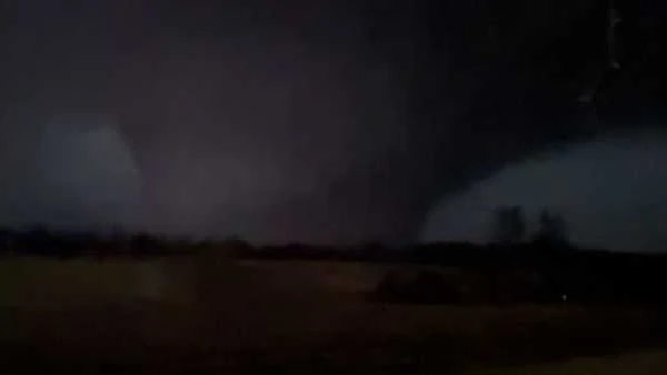
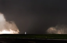
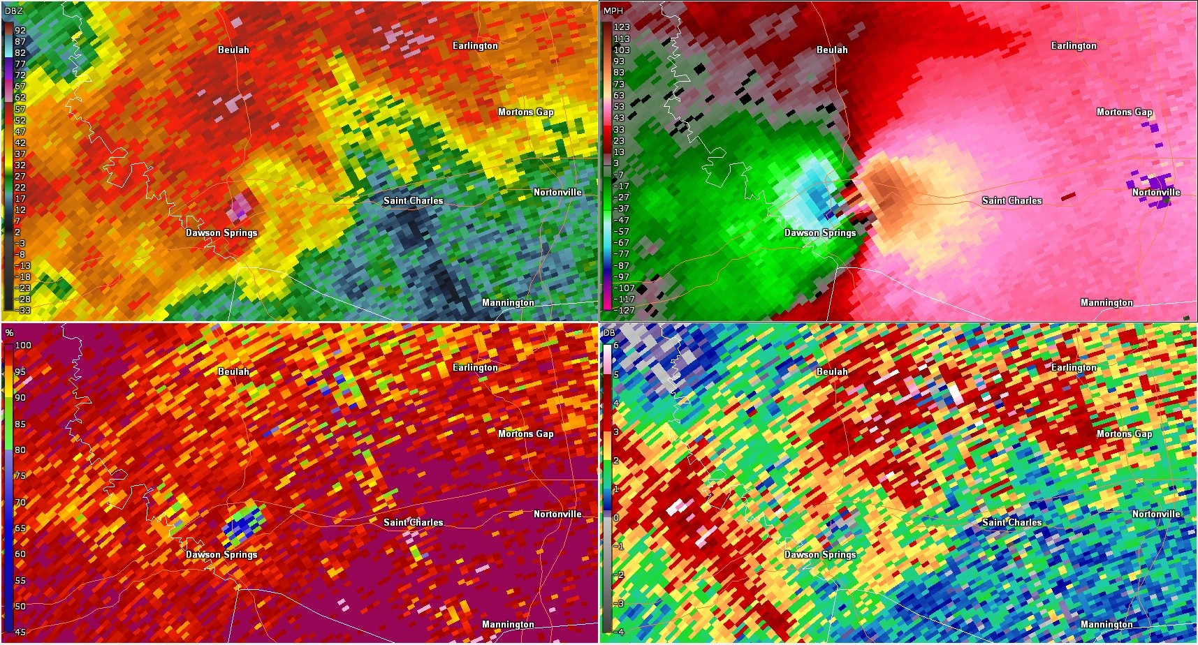
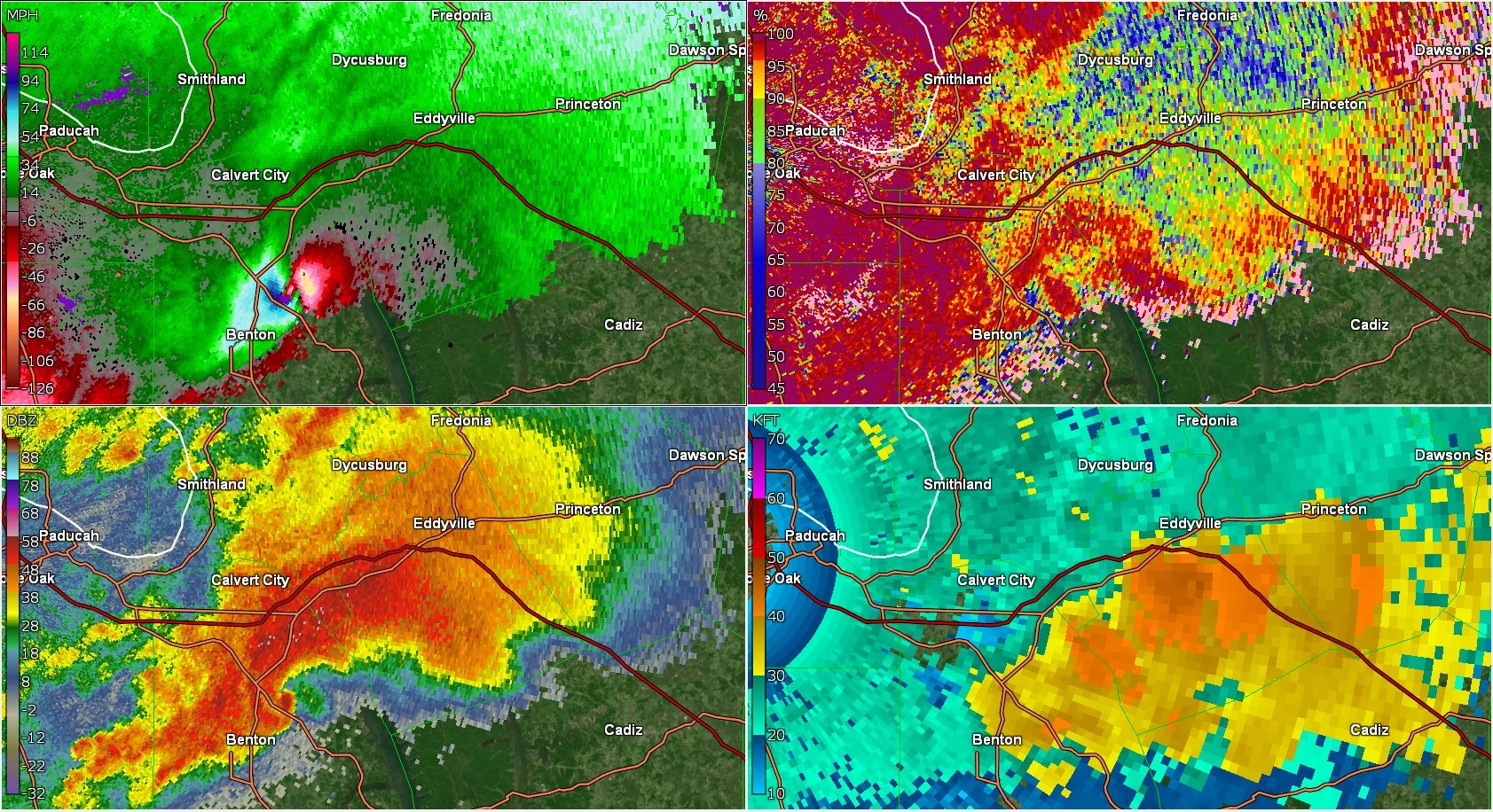
These Strong, long track, and multivortex tornadoes first touched down in Meriden CT, while the Farmington CT twin touched down in Cheshire, they both went through some big suburbs causing high end EF3 damage, ripping trees out of the ground and severely damaging houses, then the tornado Hartford twin moved into the town Berlin CT where it caused low end EF4 damage then the tornado strengthened to a EF5 in the city of New Britain CT, meanwhile the Farmington twin had moved into Southington CT and then Plainville CT causing low end EF4 damage then it moved into Farmington sling shotting and making a occlusion causing high end EF4 damage, it then fizzled out. One person who got interviewed after the storm said it looked like a bomb had gone off all over, then the Hartford twin became a large tornado and took a Northeast turn after going straight North putting the city of Hartford CT in the path, it also became heavily rain wrapped, the tornado then went into Newington CT causing low end EF5 damage, the tornado then cliped the edge of West Hartford CT causing high end EF4 damage, at this point the tornado was 2.85 miles wide and headed for downtown Hartford CT, the tornado then hit causing high end EF5 damage, most bulidings were completely slabed and some secure skyscrapers were completely slabed too, roads were completely ripped out of the ground, parts of foundations in homes were gone, the ground was scoured 2.5 feet deep, the tornado then went into East Hartford CT still causing high end EF5 damage then the tornado went into Manchester CT causing EF5 damage, it then went into Vernon CT causing low end EF5 damage, it then went into Tolland CT where it caused high end EF3 damage and then dissipated. When the NWS surved damage on the Hartford twin they estimated winds of up to 260 MPH, but a nearby mobile radar recorded winds of over 345 MPH possibly making it one of the strongest tornadoes ever in recorded history. The tornado was moving at 85 MPH helping earn its title. It would take may years for the people of Connecticut to recover from these damaging Tornadoes.
Miami EF4/EF3 and waterspout EF2.[]
")
")
")
")
")
")
.jpg "Waterspout (2).jpg (4 KB)")
")
Two significant tornadoes struck the Miami area only 1.5 hours apart. The first tornado touched down in Kendal and tracked north northeast at 45 MPH. The tornado became a strong EF2 drill bit as it teared roofs from houses and caused exterior wall damage. Cars were rolled and tossed and tress uprooted and power poles snapped. The tornado then became an EF3 as it tracked between sunset and Glenvar Heights. Mid range EF3 damage occurred here with winds estimated at 150 MPH. Several large commercial buildings lost their roofs and had some exterior wall collapses. Weaker buildings were leveled in some cases. Several apartment complexes has a similar fate with roofs removed, a few completely removed, and minor to moderate exterior wall damage. Over a hundred more buildings suffered EF2 to EF3 damage as the tornado tracked north northeast and entered South Miami. A tornado emergency was issued for parts of Miami at this point. The tornado reached peak intensity here with winds of 160 MPH. Over 50 homes had significant exterior wall damage and no roofs and cars were tossed around and smashed. Larger buildings lost windows and suffered severe roof damage with a few suffering exterior wall removal. The tornado began to slightly weaken at this point and struck both Alex Rodriguez park and cobb stadium with winds of 145 MPG. Roof damage occurred with all the stadium lights being destroyed. A building associated with the Miami PD suffered severe roof damage and had its windows blown out and vehicles destroyed. The wellness center which was part of the University of Miami near the fields had portions of its roof removed and the nets and fences around its tennis courts destroyed. Buildings north of the main University building were hit with winds of 130 MPH causing windows to be shattered and Roof damage with some exterior wall damage. Several vehicles hit the main University building causing severe damage. The weakening EF2 tornado hit several more University associated buildings before doing mid to high end EF1 damage to several houses. It then lifted. The second tornado touched down an hour and a half later in Sweetwater and began to cause EF2 damage to many buildings. The tornado quickly intensified inflicting EF3 damage to over a hundred buildings as it approached the Miami Airport. A tornado emergency was issued at this point for northern Miami. The now EF4 tornado struck the airport with 175 MPH winds causing severe damage to the the main building and destroying several planes and smaller buildings. The tornado heavily damaged over a thousand more buildings fluctuating between EF3 and EF4 intensity. The tornado appeached portions of downtown Miami causing massive damage at peak intensity of 190 MPH. Properly built structures were leveled and weaker structures swept away. Thousands of cars were tossed around like toys. Due to the extreme density of structures in this area, debris caused significant damage over a mile away. The most intense area of damage began just south of Allapatth. The tornado was half a mile wide at this point. Here a half mile wide swath of buildings were mostly leveled and several swept away. The Jackson health building suffered extreme damage with smaller buildings around leveled and the main building suffering extensive damage to the outer walls, roof and the complete destruction of the top floor. Several clusters of homes were leveled and swept away some with only the bare foundation. As the tornado began to weakened as it neared the water, the Upcomer Recording Studio was hit at high end EF3 intensity with most windows shattered and parts of the roofs and exterior walls removed. The tornado became a strong waterspout with high end EF2 to low end EF3 winds. The now EF2 waterspout struck sunset Islands and Bayshore causing severe damage. Exterior wall and roof removal was noted here. The tornado then dissipated as it moved out into the Atlantic. The last tornado in this area touched down as a waterspout near highway 213. It crossed the highway flipping cars and hitting a boating club at high end EF1 intensity causing roof damage and turning over boats. the tornado strengthened as it approached a shipping area at the port of Miami. It hit this area a its peak intensity of a high end EF2 with winds of 130 MPH destroying shipping cranes and containers. Homes on star island suffered mid range EF2 damage with some exterior wall damage and portions of roofing removed. The now EF1 tornado made landfall on West Avenue and caused moderate roof damage and flipped and rolled more vehicles. The now EF0 tornado did minimal damage in Miami Beach and dissipated back in the water.
Other:[]
The Great New York City Hail Storm
")
")
")
")
A severe thunderstorm warning was issued for the New York City metro area around 4:15 PM. The warning at first only had a threat of golf ball sized hail. This was confirmed in Morristown were significant damage resulted. As trained weather spotters kept an eye on this, they began to notice very strong and violent updrafts in excess of 160 MPH. The result from such an updraft would be hail in excess of 6 inches. As a result of the updrafts, the warning was updated to include winds up to 70 MPH and hail up to 6 inches in diameter. The storm itself was moving very slowly at about 10 MPH and had strengthen slightly more before hitting New York City. As the storm moved into the city, skies turned a violent looking dark green color and strong winds gusts started. The storm had lost only a little strength by the time it moved out into the Atlantic where a special marine warning was issued. The highest recorded gust from this storm was 75 MPH in downtown New York City and the largest hail measured was 7 inches also in New York City. It was the costliest hailstorm on record.