 | |
| Type: | Tornado outbreak sequence |
| Active: | May 27-31, 2020 |
| Duration of tornado outbreak1: | 4 days, ? hours, ? minutes |
| Maximum rated tornado2: | EF4 tornado |
| Highest winds | 170 mph tornadic (near McPherson, Kansas on May 29)
? mph non-tornadic (?,?) |
| Tornadoes confirmed: | 211 |
| Damage: | $50 million (2020 USD) |
| Injuries: | 19 |
| Fatalities: | 0 |
| Areas affected: | Kansas, Oklahoma, Texas, Colorado, Nebraska, Missouri, Iowa, Illinois |
|
1Time from first tornado to last tornado | |
The tornado outbreak sequence of May 27-31, 2020 was a multi-day severe weather episode which spawned 211 tornadoes across the central and southern Plains states, as well as the Midwest. The event featured several significant tornadoes, the strongest of which an EF4 that passed near McPherson, Kansas on May 29. The busiest day of the outbreak was May 28, on which 72 tornadoes occurred. This outbreak sequence affected much of the same regions previously struck by other outbreaks earlier in the month from May 4-6 and on May 22. Many tornadoes in this outbreak remained in mostly unpopulated areas, resulting in limited damage aside from a few cases.
Meteorological synopsis[]
Overview[]
Following the exit of the trough which prompted the tornado outbreak of May 22, 2020, a much more broad, large-scale trough took hold in the western United States. This pattern is extremely favorable for plains severe weather events, especially when stronger shortwaves can eject over the Plains as they revolve around the base of the large-scale trough. Models picked up on an upcoming increase in severe weather potential as early as May 20, and in the coming days it became apparent to forecasters that a multi-day severe weather episode was likely in the Plains to end the month of May. The event is one of the most active periods of tornadic activity in the month of May on record, in large part due to the highly favorable kinematic and thermodynamic environments on each day during the event. In the end the setup spawned 211 tornadoes over the five day span.
May 27[]
The first day of the sequence took place in the Texas and Oklahoma panhandles, extending into southwest Kansas. The SPC issued an enhanced risk with a 10% significant tornado risk for a corridor arcing northeast from Amarillo to Dodge City. Supercells were expected to develop along the dry line that evening in the Texas panhandle, with additional storms developing to the northeast into southwest Kansas, all of which having a tornado threat, given 0-3km SRH in the 250-350 m2/s2 range, dew points of about 70° in the region, and ample instability. Storms began developing at about 4:00 PM CDT, and a tornado watches were issued for much of the risk area. One tornado which struck Borger, Texas, received an EF3 rating. Three other strong tornadoes impacted the Texas panhandle that evening, as well. Additional tornadic activity occurred in the Oklahoma panhandle, as well as in southwest Kansas, where numerous weak tornadoes touched down. A few other tornadoes touched down in Colorado on May 27, as well. Activity quickly tapered off after sunset.
May 28[]
West, central KS / Northwest, north, central OK (+ other areas) May 28 was anticipated to be the biggest day of the sequence, and a moderate risk had been in place for the high plains of western Kansas into northwest Oklahoma since the day three convective outlook. Strong shear coupled with temperatures in the lower 80°s, dew points in the lower 70°s, and MLCAPE of about 3,500 j/Kg in much of the region set the stage for a large severe weather event. A moderate risk remained in place on the morning of May 28, with a 15% significant tornado risk extending from northwest Kansas into northwest Oklahoma. A high risk was considered by the SPC, but there was too much uncertainty regarding rapid upscale growth caused by too much forcing. This concern did not come to fruition, and several semi-discrete supercells developed across the region that evening. Two PDS tornado watches were issued that afternoon: one in central and northwestern Kansas, and one in southwest Kansas and northwest Oklahoma. Storms moved generally in a northward and north-northeasterly direction and were cyclical, often producing several tornadoes over their lifetimes. 72 tornadoes struck the region that evening, including five EF3s. Upscale growth occurred during the nighttime hours, resulting in a large MCS which moved across Kansas before weakening early in the morning of May 29. The MCS left behind notable outflow boundaries which would be the focal point for tornadic supercells in Kansas the following day.
May 29[]
The setup on May 29 was, at first glance, the least favorable of the sequence. Shear was weaker, but still adequate, than on May 27 and May 28, although directionally the shear was favorable. Thermodynamics were favorable for severe thunderstorms, too, with temperatures in the mid-80°s and dew points ranging from the mid-60°s to lower 70°s in Kansas. The issue, however, was a very strong cap that overspread the region. The SPC had issued a slight risk, with an attendant 5% tornado risk, for central and south Kansas, mentioning a conditional supercell threat in their discussion. If the cap could break by evening, the environment would be conductive for supercells capable of producing tornadoes and very large hail. It was observed on visible satellite imagery that an outflow boundary had been left behind from storms on May 28, which ran west to east around Geneseo to Lincolnville, Kansas. The SPC noted that any storm that could both form and move along this outflow boundary would have an enhanced strong tornado threat. Storms began to develop around 6:00 PM CDT in central Kansas, along the nose of the highest CAPE values. Initially cumulus towers couldn't break the strong cap, but one updraft pushed through. The resulting supercell went on to produce the strongest tornado of the outbreak, an EF4 that tracked just north of McPherson, Kansas. Several other tornadoes touched down in Kansas that evening into that night, bringing the total number of tornadoes on May 29 to 25. Given the isolated nature of the storms on May 29, activity weakened fairly quickly during the nighttime hours.
May 30[]
KS / MO (+ other areas) May 30 was the second largest day of the sequence, with 52 tornadoes touching down, including two EF3s. There was an enhanced risk from eastern Kansas into western and northwestern Missouri, which was upgraded to a moderate risk for both tornadoes and hail on the morning of May 30 in a corridor from Emporia, Kansas to Marshall, Missouri, which included the Kansas City area. Storms were expected to develop along a west-to-east axis across the moderate risk area that afternoon and evening, moving in an east-northeast direction. The atmosphere was extremely unstable on May 30, with CAPE values reaching 4,500-5,000 j/kg across much of the warm sector, and favorable shear for supercells overspreading the region. Many semi-discrete high-precipitation supercells developed during the mid-afternoon hours, spawning 52 tornadoes. One low-end EF3 tornado impacted the southern Kansas City metro area, though no fatalities occurred with the event. Considerable upscale growth occurred into the evening hours, effectively reducing the overall tornado threat after sunset, though isolated damaging wind and hail persisted across Missouri through the overnight hours. (EDIT)
May 31[]
MO / IL (+ other areas) The final day of the sequence featured less of a tornado threat initially, with only a 10% tornado risk issued by the SPC, stretching from eastern Missouri into central Illinois. Damaging winds were the main concern, for which there was a moderate risk, and a squall line was expected to form that afternoon. A squall line did develop, but there were a few embedded supercells which spawned several tornadoes into the evening. None of these tornadoes were particularly strong, but 28 managed to touch down, making for quite a busy tornado day. After sunset, the squall line gradually tapered off, bringing an end to the outbreak sequence.
Tornado table[]
| State | Total | EF0 | EF1 | EF2 | EF3 | EF4 | EF5 |
|---|---|---|---|---|---|---|---|
| May 27 | 34 | 22 | 8 | 3 | 1 | 0 | 0 |
| May 28 | 72 | 38 | 21 | 8 | 5 | 0 | 0 |
| May 29 | 25 | 11 | 11 | 2 | 0 | 1 | 0 |
| May 30 | 52 | 24 | 22 | 4 | 2 | 0 | 0 |
| May 31 | 28 | 9 | 17 | 2 | 0 | 0 | 0 |
| Total | 211 | 104 | 79 | 19 | 8 | 1 | 0 |
List of confirmed tornadoes[]
May 27 event[]
| List of confirmed tornadoes - May 27, 2020 | ||||||
|---|---|---|---|---|---|---|
| Texas | ||||||
| EF0 | WSW of Adrian | Oldham | 2148 | 0.5 mi | Brief tornado did limited damage in the area. | |
| EF3 | Borger | TBD | 0032 | 19.8 mi | TBD | |
| EF0 | TBD | TBD | TBD | TBD mi | TBD | |
| EF2 | TBD | TBD | TBD | TBD mi | TBD | |
| EF0 | TBD | TBD | TBD | TBD mi | TBD | |
| Kansas | ||||||
| EF0 | TBD | TBD | TBD | TBD mi | TBD | |
| EF2 | TBD | TBD | TBD | TBD mi | TBD | |
| Colorado | ||||||
| EF0 | TBD | TBD | TBD | TBD mi | TBD | |
| Oklahoma | ||||||
| EF0 | TBD | TBD | TBD | TBD mi | TBD | |
May 28 event[]
| List of confirmed tornadoes - May 28, 2020 | ||||||
|---|---|---|---|---|---|---|
| Kansas | ||||||
| EF3 | SW of Ransom | Ness | TBD | 10.67 mi | TBD | |
| Colorado | ||||||
| EF0 | TBD | TBD | TBD | TBD mi | TBD | |
| Oklahoma | ||||||
| EF3 | TBD | TBD | TBD | TBD mi | TBD | |
| Nebraska | ||||||
May 29 event[]
| List of confirmed tornadoes - May 29, 2020 | ||||||
|---|---|---|---|---|---|---|
| Kansas | ||||||
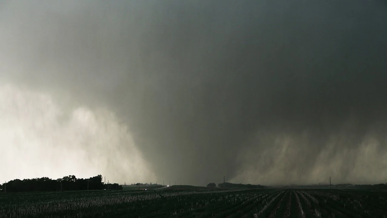
| EF4 | ESE of Little River to N of McPherson to NW of Canton | Ellsworth, McPherson | 0002 | 26 mi | This violent wedge tornado began in the Little River area and began moving ENE at about 20 mph. Damage was initially weak and fairly sparse, as very few structures were in the path. The tornado rapidly intensified, however, producing low-end EF3 damage to a house on Ave J, and severely mangled irrigation pivots in a nearby field. EF2 and EF3 damage was again noted to two farm homes on Moccasin Road. At this stage the tornado grew to a large wedge about 3/4 miles wide. It was moving through very open spaces, producing only vegetation damage; grass was scoured slightly, trees were debarked, and cycloidal ground swirls were noted. The first instance of EF4 damage was noted to a home off of 8th Ave, about 7 miles NW of McPherson. There, a home was leveled to the ground with some debris pushed off the foundation, with estimated wind speeds of 170 mph. A nearby barn was swept away. EF3 damage occurred to a farm home on 9th Ave, with its outbuildings being flattened or swept away. A barn near Clear Pond was completely swept away with debris scattered in fields to the east. The tornado then entered very rural areas yet again, not producing damage to structures again until EF2 damage was noted to a home on Mohawk Road. At this stage, the tornado was a violent wedge, and it was visible from McPherson; it passed just north of the city, but prompted a PDS tornado warning for the area. High-end EF3 damage occurred to two homes on 16th Ave before it crossed Highway 81. EF4 damage occurred yet again in a community on Mohawk Road and 17th Ave, with three homes being leveled. Two people were injured there. The tornado then began to weaken, producing EF1-EF2 damage for the remainder of the path until dissipating NW of Canton at 8:16 PM CDT | |
| EF2 | NNE of Goessel | Marion | 0126 | 4.67 mi | Strong EF2 tornado began shortly after the McPherson area EF4 dissipated. Trees were denuded and uprooted, several outbuildings were destroyed, and an irrigation pivot was severely mangled. | |
| EF0 | TBD | TBD | TBD | TBD mi | TBD | |
| EF0 | TBD | TBD | TBD | TBD mi | TBD | |
| EF0 | TBD | TBD | TBD | TBD mi | TBD | |
| EF0 | TBD | TBD | TBD | TBD mi | TBD | |
May 30 event[]
| List of confirmed tornadoes - May 30, 2020 | ||||||
|---|---|---|---|---|---|---|
| Kansas | ||||||
| EF0 | TBD | TBD | TBD | TBD mi | TBD | |
| EF1 | TBD | TBD | TBD | TBD mi | TBD | |
| Missouri | ||||||
May 31 event[]
| List of confirmed tornadoes - May 31, 2020 | ||||||
|---|---|---|---|---|---|---|
| Missouri | ||||||
| Illinois | ||||||